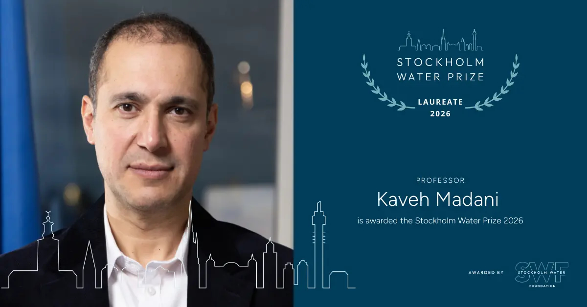
Water Wasted to the Sea?

By James E. Cloern, Jane Kay, Wim Kimmerer, Jeffrey Mount, Peter B. Moyle and Anke Müeller-Solger

This essay is a condensed version of one that appeared in the journal San Francisco Estuary and Watershed Science (Vol. 15, Issue 2, Article 1), in July 2017.  The complete article with references and author’s contact information can be found at:

https://escholarship.org/uc/item/2d10g5vp

If we farmed the Central Valley or managed water supplies for San Francisco, San Jose, or Los Angeles, we might think that freshwater flowing from the Sacramento and San Joaquin Rivers through the Delta to San Francisco Bay is “wasted” because it ends up in the Pacific Ocean as an unused resource. However, different perspectives emerge as we follow the downstream movement of river water through the Delta and into San Francisco Bay.

If we were Delta farmers or administered Contra Costa County’s water supply, we would value how high flows reduce salt intrusion (Jassby et al. 1995) and protect water quality for drinking, growing crops, and meeting other customer needs.

If we were responsible for protecting at-risk species, we would value river water that flows through the Delta to the Bay and ocean because it stimulates migration and spawning of native Chinook salmon, Delta Smelt, Longfin Smelt, and Sacramento Splittail, while also reducing the potential for colonization and spread of non-native fishes (Brown et al. 2016). River flow reduces toxic selenium concentrations in clams eaten by sturgeon, splittail, and diving ducks (Stewart et al. 2013), and it delivers plankton and detritus to fuel production in downstream food webs (Sobczak et al. 2002).

If we managed a Bay Area storm water district or sewage treatment plant, we would value water that flows from the Delta into the Bay because it dilutes and flushes such urban pollutants as metals, microplastics, and nutrients (McCulloch et al. 1970).

If we directed restoration projects around the Bay, we would value water that flows from the Delta into the Bay because it brings sediment required to sustain marshes that otherwise would be lost to subsidence and sea level rise (Stralberg et al. 2011; Schoellhamer et al. 2016). Sediment supplies from rivers also sustain mudflats (Jaffe et al. 2007) used as habitat and probed for food by more than a million willets, sandpipers, dunlins, and other shorebirds during spring migration (Stenzel et al. 2002).

If we fished the Pacific for a living, we would value river flow into the Bay because it carries cues used by adult salmon to find their home streams and spawn (Dittman and Quinn 1996), it brings young salmon to the sea where they grow and mature, and it creates bottom currents that carry young English Sole, California Halibut, and Dungeness crabs into the Bay (Raimonet and Cloern 2016) where they feed and grow before returning to the ocean.

If we liked to romp along the shore or served on the California Coastal Commission, we would value rivers that flow to the sea because they supply the sand that keeps California’s beaches from eroding (Barnard et al. 2017).

Finally, if we were among those who want to conserve California’s landscape and biological diversity, we would value river water that flows to the sea because it creates one of the nation’s iconic estuaries, and sustains plant and animal communities found only where seawater and freshwater mix (Cloern et al. 2016).

Is the fresh river water that naturally flows through the Delta to San Francisco Bay and on to the Pacific Ocean “wasted?” No. The seaward flow of fresh water is essential to farmers, fishers, conservationists, seashore lovers, and government agencies that manage drinking water supplies, restore wetlands, protect coastlines, and clean up sewage and storm pollution. Wasted water to some is essential water to others.

Travis Hiett of USGS measures high flows on the Cosumnes River, December 31, 2022, from the bridge at Michigan Bar. Flows were estimated at 63,700 cfs. USGS Photo by Sue Brockner.

Further Reading

Barnard PL, Hoover D, Hubbard DM, Snyder A, Ludka BC, Allan J, Kaminsky GM, Ruggiero P, Gallien TW, GabelL, McCandless D, Weiner HM, Cohn N, AndersonDL, Serafin KA. 2017. Extreme oceanographic forcing and coastal response due to the 2015-2016 El Niño. Nat Commun 8:14365. https://doi.org/10.1038/ncomms14365

Brown LR, Kimmerer W, Conrad JL, Lesmeister S, Müeller–Solger A. 2016. Food webs of the Delta, Suisun Bay, and Suisun Marsh: an update on current understanding and possibilities for management. San Franc Estuary Watershed Sci 14(3). https://doi.org/10.15447/sfews.2016v14iss3art4

Cloern JE, Barnard PL, Beller E, Callaway JC, GrenierJL, Grosholz ED, Grossinger R, Hieb K, Hollibaugh JT, Knowles N, Sutula M, Veloz S, Wasson K, Whipple A. Life on the edge—California’s estuaries. In: Mooney H, Zavaleta E, editors. 2016. Ecosystems of California: a source book. Oakland (CA): University of California Press. p 359-387.

Dittman A, Quinn T. Homing in Pacific salmon: mechanisms and ecological basis. J Exp Biol (1):83-91. https://doi.org/10.1242/jeb.199.1.83

Jaffe BE, Smith RE, Foxgrover AC. 2007. Anthropogenic influence on sedimentation and intertidal mudflat change in San Pablo Bay, California: 1856-1983. Estuar Coastal Shelf Sc 73:175-187. https://doi.org/10.1016/j.ecss.2007.02.017

Jassby AD, Kimmerer WJ, Monismith SG, Armor C, CloernJE, Powell TM, Schubel JR, Vendlinski TJ. 1995. Isohaline position as a habitat indicator for estuarine populations. Ecol Appl 5(1):272-289. https://doi.org/10.2307/1942069

McCulloch DS, Peterson DH, Carlson PR, Conomos TJ. 1970. Some effects of fresh-water inflow on the flushing of South San Francisco Bay—a preliminary report: U.S. Geological Survey Circular 637A. 27 p.

Raimonet M, Cloern JE. 2016. Estuary-ocean connectivity: fast physics and slow biology. Global Change Biology [Internet]. [cited 2017 March 18]. Available from: http://onlinelibrary.wiley.com/doi/10.1111/gcb.13546/full

Schoellhamer DH, Wright SA, Monismith SG, BergamaschiBA. 2016. Recent advances in understanding flow dynamics and transport of water-quality constituents in the Sacramento–San Joaquin River Delta. San Franc Estuary Watershed Sci 14(4). https://doi.org/10.15447/sfews.2016v14iss4art1

Sobczak W, Cloern J, Jassby A, Müeller-Solger A. 2002. Bioavailability of organic matter in a highly disturbed estuary: the role of detrital and algal resources. Proc National Acad Sci USA 99(12):8101-8105. https://doi.org/10.1073/pnas.122614399

Stralberg D, Brennan M, Callaway JC, Wood JK, SchileLM, Jongsomjit D, Kelly M, Parker VT, Crooks S. 2011. Evaluating tidal marsh sustainability in the face of sea-level rise: a hybrid modeling approach applied to San Francisco Bay. PloS one 6(11):e27388. https://doi.org/10.1371/journal.pone.0027388

Stenzel LE, Hickey CM, Kjelmyr JE, Page GW. 2002. Abundance and distribution of shorebirds in the San Francisco Bay area. Western Birds 33:69-98. Available from: https://www.westernfieldornithologists.org/archive/V33/33(2)%20p0069-p0098.pdf

Stewart AR, Luoma SN, Elrick KA, Carter JL, van der Wegen M. 2013. Influence of estuarine processes on spatiotemporal variation in bioavailable selenium. Mar Ecol Prog Ser 492:41-56. https://doi.org/10.3354/meps10503

Posted in Uncategorized | 6 Comments

What’s the dam problem with deadbeat dams?

by Andrew L. Rypel, Christine A. Parisek, Jay Lund, Ann Willis, Peter B. Moyle, Sarah Yarnell, Karrigan Börk

*this is a repost of a blog originally published in June 2020.

Damming rivers was once a staple of public works and a signal of technological and scientific progress. Even today, dams underpin much of California’s public safety and economy, while having greatly disrupted native ecosystems (Quiñones et al. 2015, Moyle et al. 2017), displaced native peoples (Garrett 2010), and deprived residents of water access when streamflow is transported across basins. California’s dams are aging and many will require expensive reconstruction or rehabilitation. Many dams were built for landscapes, climates and economic purposes that no longer exist. California’s current dams reflect an accumulation of decisions over the past 170 years based on environmental, political, and socio-economic dynamics that have changed, sometimes radically. Former Secretary of the Interior Bruce Babbitt remarked, “Dams are not America’s answer to the pyramids of Egypt… Dams do, in fact, outlive their function. When they do, some should go.

Is California prepared for updating or removing this infrastructure, and what would be the consequences of inaction?

Fig. 1. Transformation of the West through government funded irrigation. From: Donald J. Pisani, To Reclaim a Divided West: Water, Law, and Public Policy, 1848-1902 125 (University of New Mexico Press, 1992)

We examined the National Inventory of Dams (NID) to assess the state of California’s dams. This database is a large data product curated by the US Army Corps of Engineers and contains information on most large dams in the USA (Fig. 2, 3, Table 1). Across the nation there are 91,468 NID dams, with 1,580 in California. Because there are multiple dams on some reservoirs, we estimate a total of 80,101 and 1,444 NID reservoirs in the USA and California, respectively.

Mean age of USA dams is 59 years old; but mean age of California dams is 72 years (Fig. 3). The 25% oldest CA dams are 93 years or older. California’s total reservoir storage capacity behind NID dams is 45 million acre-feet with a total reservoir surface area of 713,146 acres. For comparison, the total surface area of all managed natural lakes in Wisconsin is 943,130 acres, supporting a massive tourism industry (Rypel et al. 2019). Unfortunately, 1,097 (69%) of California NID dams are listed as high or significant hazards to human communities if they fail (Fig. 2, Table 2). These counts greatly underestimate problematic dams. In the USA, there are hundreds of thousands of smaller (often old) dams that fall outside of state and federal lists, and so are not included in the NID. This issue is broader than just dams too – infrastructure of all varieties is aging, representing a growing problem for humans and wildlife (Börk and Rypel 2020).

Fig. 2A. Map of all California dams in the NID.
Fig. 2B. Map of all NID dams in the contiguous USA. In both maps red circles represent dams classified in the NID as “high hazard” (i.e.,the potential for dam failure or facilities mis-operation to result in loss of human life, in addition to lower risk characteristics such as potential for economic and environmental losses). Gray circles represent all other dams.

Fig. 3. Histograms describing characteristics of dams and reservoirs in the USA and California. All data are from the National Inventory of Dams database. All log transformed data are (Log+1) transformations, however mean values in text boxes are non log-transformed values. Year Dam Completed was cropped at >1750 for ease of viewing.

We have already witnessed examples of the high cost of inaction. Recently in Michigan, two dams (Edenville and Sanford) failed and forced the evacuation of 10,000 residents in the midst of the COVID-19 pandemic – essentially a worst case scenario. Extreme rain in the midwest led to historic flooding in the Tittabawasse and Tobacco Rivers. Federal regulators had worried about failures at the Edenville Dam for 30 years due to an undersized spillway (see related news stories 1, 2, 3, 4).

Table 1. Summary statistics on age and storage capacity of dams and reservoirs in the USA and California.

Fig. 4. Oroville’s failing primary spillway during spring 2017. Photo source: wikicommons.org

In California, we recall a near miss when the Oroville Dam spillway failed in early spring 2017. Floods damaged the primary spillway such that the California Department of Water Resources stopped flow over the spillway to better assess damage. Lake levels continued to fill and ultimately overtopped the emergency spillway, triggering unexpected erosion around the emergency spillway and the evacuation of 188,000 residents downstream. An independent forensic report of the Oroville incident highlights several lessons, including the need for periodic review of dam design and performance. Dams in California have failed before and a list of major events can be found here and here. Recent evaluations have indicated that conditions of California dams are below average, with one reporting a statewide grade of “C-” (Moser and Hart 2018; https://www.infrastructurereportcard.org/state-item/california/).

Table 2. Summary of hazard classifications for USA and California dams based on the NID. The NID defines hazard potentials as: “High” –  dam failure is likely to result in loss of human life. “Significant” – likely no risk to human life, but a likelihood to cause economic and/or environmental losses. “Low” – likely no risk to human life and low anticipated economic and/or environmental losses. “Undetermined” – hazard designation not assigned; here, dams classified as “undetermined” were grouped with dams that had an N/A hazard potential.

Dams also can have catastrophic effects on natural ecosystems, especially in productive and species-rich large rivers (Poff et al. 1997). Dams fragment the hydrologic connectivity of ecosystems, and create massive physical barriers for migratory species, including salmon. American rivers are so extensively fragmented by dams, that Benke (1990) estimated only 42 high quality free-flowing rivers remain in the USA – zero in California. In the Sacramento Valley, abundant spring-run Chinook salmon would once migrate long distances and over-summer high in cold mountain streams. Now, spring-run Chinook salmon are listed under the US Endangered Species Act, largely because of disruptions from dams. In the San Joaquin River, construction of Friant Dam preceded a rapid eradication of spring-run Chinook from this ecosystem. Expensive efforts to reintroduce spring-run Chinook salmon hold promise; but fish are still fundamentally blocked from naturally cold habitats by rim dams. The McCloud River once had all four runs of Chinook salmon, plus steelhead and bull trout. None of these species occur in the McCloud River anymore, and bull trout have gone extinct in California. Helfman (2007) suggested that ~70% of global freshwater fish extinctions can be attributed to “habitat change,” including effects of dams.

Fig. 5. Migratory salmon are strongly and negatively affected by dams. This photo shows the types of habitats that salmon often cannot ascend to in California any longer. “Salmon on spawning beds” by John Cobb 1917 in Pacific Salmon Fisheries. Annual Report to the Secretary of Commerce, 1915-1916, Washington DC. Downloaded from Wikicommons and the Freshwater and Marine Image Bank.

Beyond the catastrophic failures and ecological impacts of individual dams, California’s dams create disastrous outcomes for disadvantaged communities, including Native American Tribes. Tribes along the Klamath have spent years struggling to preserve the river and its sensitive salmon populations. Removing deadbeat dams like the four major dams on the Klamath River along the CA-OR border exemplify the types of projects where removal makes economic sense to dam owners and begins to address damage to indigenous communities of color and aquatic ecosystems. NGOs have long been interested in dam removals like this. However, the slow speed of these removals highlights the complicated details involved in removal. Such experiences suggest efforts addressing aging dams must start early.

The California Division of Safety of Dams (DSOS) has existing responsibilities that include: 1) Performing independent analyses to understand dam and appurtenant structures performance; 2) Overseeing construction to ensure work is being done in accordance with approved plans and specifications; and 3) Inspecting dams on an annual basis to ensure it is safe, performing as intended, and is not developing issues. Roughly 1/3 of these inspections include in-depth instrumentation reviews of the dam surveillance network data. Every state (except GA) has a dam safety program, and the CA program is the largest in the USA. Therefore, the DSOD plays a major role in working with dam owners to identify deficiencies in California. The size of the DSOS program suggests this resource could be leveraged in CA to take a leading role in dam safety. Response to aging dams has been mostly reactive. Studies of dam behavior during earthquakes has been a long focus of research, and such questions are obviously important in California. In a 1977 USGS analysis of dam structural behavior during Earthquakes, half the study systems were in California. Many of the major dam failures in California were triggered by earthquakes.

California is well-positioned to lead in proactively addressing aging dams; however, the window for leadership is likely closing. The challenge will be in developing balanced approaches that prioritize the dams, rivers and people in most need of help (Null et al. 2014). To advance policy on dealing with obsolete dams, we suggest California should:

(1) Form a “California Dams Blue Ribbon Panel”. Given recent experiences in California and nationally, it seems timely for the State of California to take stock and assess the long-term performance of its dam regulation capabilities. Efforts are needed to assist the public, local governments, and dam owners in identifying at-risk dams in need of action. A California dams blue ribbon panel would help develop a framework for decision making that could be applied to dams across the state. The panel’s charge would be to: i) evaluate the state’s existing regulatory framework for evaluating public safety and environmental performance of dams; ii) estimate overall magnitude of current and future dam safety and environmental problems (especially with climate change); iii) recommend improvements to state regulatory capacities and support for owners in terms of dam safety and environmental performance. Panel findings might be published as a white paper for others to use and reference. The panel should have broad representation from multiple stakeholder groups including roles for Native American tribes and other disadvantaged and at-risk communities. Ultimately, a blue ribbon panel and white paper format would produce faster results than a larger task-force style effort, but could lead to a larger effort if necessary.

(2) Develop a structured assessment tool. An objective science-based prioritization framework would be useful. Structured assessments are a class of tools that can more transparently and objectively analyze natural resource management decisions in a careful and organized way (Gregory et al. 2011). Such models are popular in some federal agencies and have already aided decision-making in other areas of CA state government, such as welfare services. A directed action to build such a tool could rapidly aid agencies charged with managing aging dams and scoring restoration projects. Once the tool is available, proposed on-the-ground restoration projects could be scored more transparently. Projects that propose work on high priority dam sites might then be prioritized for funding. Thus restoration projects funded through state bond propositions (e.g., Prop 1 and Prop 68) net the state and its investors the most “bang for their buck”, while simultaneously leveraging science and enhancing transparency and accountability. Improvements to the assessment method could form a way of incorporating new scientific findings or ways of thinking over time.

(3) Revisit existing legal frameworks. Dams sit at the crossroads of state and federal law and so face a complex mess of state and federal laws and regulation. Prominent legal issues will include liability for flooding and for environmental damages associated with dam removal (which will differ between privately and publicly owned dams), environmental reviews mandated under state and federal endangered species and environmental impact laws, and the myriad dam-specific laws. This is an area of active research in environmental law (see here recents legal debates on issues facing dams in the Western USA). Some examples of laws that have legal relevance to the operation and use of dams include the California Fish and & Game Code 5937 – “Water for Fish” (Börk et al. 2012). Additionally, under the authority of the Federal Power Act, the Federal Energy Regulatory Commission (FERC) retains exclusive authority to license non-federal hydropower projects on navigable waterways, federal lands, or areas connected to the interstate electric grid. Opportunities for dealing with deadbeat dams also present themselves during the FERC relicensing process. Indeed this was a critical piece to the removal of the Klamath Dams. Most dams currently face little regulation and receive little attention from policy makers.

(4) Explore reservoirs as novel habitats for declining fishes. Because many California reservoirs contain expansive coldwater habitats, scientists have occasionally suggested reservoirs could be capable of serving as emergency rooms for declining native fishes. Some California reservoirs have developed self-sustaining populations of Chinook salmon (Perales et al. 2015). These populations may be needed as a backup plan in the event a disease or other disturbance afflicts the primary Sacramento River salmon runs. We support this concept and note that some reservoirs and dams may hold hidden value in this regard. Reservoirs successfully managed as novel habitat for native fishes might ultimately be scored higher for dam renovation or repurposing funds.

Every dam is unique and there will be no one-size-fits-all approach. Ultimately dams are owned by entities ranging from the state of California, water agencies and districts, counties, cities, homeowner’s associations, private companies, or private citizens. Hansen et al. 2020 identified that in general dams can be mitigated, renovated, repurposed, or eliminated. In California, dams have been important in controlling water availability, both reducing the frequency of catastrophic floods and making water available for cities and irrigated agriculture in our highly variable Medeterranean climate. They will remain vital in the future, perhaps even more so with anticipated changes in climate. Ultimately, some dams will be fine, some will need to be removed, and some modified. At this point however, an overarching strategy is needed to guide efforts to identify which dams are suited to our uncertain future and which are more risky than worthwhile, then rank them with the best rubric we can devise (e.g..Quiñones et al. 2015). Planning for aging dams is not unlike planning for a pandemic. It seems as though you don’t need it…until you do.

Fig. 6. The upper Klamath River in Oregon was once accessible to salmon migrating from the Pacific Ocean through California. The Klamath dam removals promise to reconnect some of these habitats. Photo by Bob Wick, source Wikicommons.org

Further Reading

ASCE Committee on America’s Infrastructure. 2017. Infrastructure in California. ASCE: Reston, Virginia. https:// www.infrastructurereportcard.org/state-item/california/

Benke, A.C. 1990. A perspective on North America’s vanishing streams. Journal of the North American Benthological Society 9: 77-88.

Börk, K.S., J.F., Krovoza, J.V. Katz and P.B. Moyle. 2012. The rebirth of California Fish & Game Code Section 5937: water for fish. UC Davis Law Review 45: 809-913.

Börk, K., and A.L. Rypel. 2020. Improving infrastructure for wildlife. Natural Resources & Environment.

France, J.W., I.A. Alvi, P.A. Dickson, H.T. Falvey, S.J. Rigbey, and J. Trojanowski. 2018. Independent forensic team report Oroville Dam spillway incident. Technical Report.

Garrett, B.L. 2010. Drowned memories: the submerged places of the Winnemem Wintu. Archaeologies 6: 346–371.

Gregory, R., L. Failing, G. Long. T. McDaniels, and D. Ohlson. 2011. Structured Decision Making: A Practical Guide to Environmental Management. Wiley-Blackwell, West Sussex, UK

Grabowski, Z.J., H. Chang, and E.F. Granek. 2018. Fracturing dams, fractured data: Empirical trends and characteristics of existing and removed dams in the United States. River Research and Applications 34: 526-537. 

Grantham, T., and P. Moyle. Flagging problem dams for fish survival. California WaterBlog, October 24, 2014.

Hansen, H.H., E. Forzono, A. Grams, L. Ohlman, C. Ruskamp, M.A. Pegg, and K.L. Pope. 2020. Exit here: strategies for dealing with aging dams and reservoirs. Aquatic Sciences 82.

Helfman, G.S. 2007. Fish conservation: a guide to understanding and restoring global aquatic biodiversity and fishery resources. Island Press, Washington D.C. USA.

Moser, S.C., and J.F. Hart. 2018. Paying it forward: the path toward climate-safe infrastructure in California. A report of the climate-safe infrastructure working group to the California State Legislature. Technical Report.

Null, S.E., J. Medellin-Azuara, A. Escriva, M. Lent, and J. Lund. 2014. Optimizing the  195–215Dammed: Water Supply Losses and Fish Habitat Gains from Dam Removal in California. Journal of Environmental Management 136: 121-131.

Perales, K.M., J. Rowan, and P.B. Moyle. 2015. Evidence of landlocked Chinook Salmon populations in California. North American Journal of Fisheries Management 35:1101–1105.

Poff, N.L., J.D. Allan, M.B. Bain, J.R. Karr, K.L. Prestegaard, B.D. Richter, R.E. Sparks, and J.C. Stromberg. 1997. The natural flow regime. BioScience 47: 769-784.

Quiñones, R.M, T. Grantham, B. N. Harvey, J. D. Kiernan, M. Klasson, A. P. Wintzer and P.B. Moyle. 2015. Dam removal and anadromous salmonid (Oncorhynchus spp.) conservation in California. Reviews in Fish Biology and Fisheries 25: 195–215. 

Rypel, A.L., T.D. Simonson, D.L. Oele, J.D.T Griffin, T.P. Parks, D. Seibel, C.M. Roberts, S. Toshner, L.S. Tate, and J. Lyons. 2019. Flexible classification of Wisconsin lakes for improved fisheries conservation and management. Fisheries 44: 225-238.

US Army Corps of Engineers: Federal Emergency Management Agency. National Inventory of Dams. 2018. Washington, DC USA https://nid.sec.usace.army.mil/ords/f?p=105:1.

https://www.nationalgeographic.com/science/2020/05/problem-america-neglected-too-long-deteriorating-dams/

https://www.bridgemi.com/michigan-environment-watch/feds-revoked-dams-license-over-safety-issues-then-michigan-deemed-it-safe

https://www.hcn.org/issues/50.10/tribal-affairs-how-the-yurok-tribe-is-reclaiming-the-klamath-river

https://www.buzzfeednews.com/article/danvergano/california-dams-climate-change.

https://,www.mercurynews.com/2020/06/08/anderson-dam-draining-to-start-oct-1-could-take-six-months-to-empty/

Posted in Uncategorized | Tagged , , , , , , , , , , , , | 6 Comments

Whiplash Again! – Learning from Wet (and Dry) Years

by Jay Lund, Deirdre Des Jardins, Kathy Schaefer

Tulare Lake in July 1983 and May 2023

“Old superlatives have been dusted off and new ones count to better describe the tragedy, damage, and trauma associated with the State’s latest ‘unusual’ weather experience.” DWR Bulletin 69-83, California High Water 1982-83, p.1

“California’s climate has often been described as variable, inconsistent, and unpredictable. The meteorological events of the last few years give additional credence to those observations. The two extremes of weather patterns the record back-to-back dry years of 1976-77 and the all-time record of consecutive wet water years, 1981-82 and 1982-83 — have now been recorded in less than a single decade!” DWR Bulletin 69-83, California High Water 1982-83, p.1

In July 1984, the California Department of Water Resources issued Bulletin 69-83, California High Water 1982-83.  It insightfully reviewed what is still California’s wettest water year in more than a century.  Reading this report gives a sense of California’s broad and eternal flood vulnerabilities and management problems.  Despite important advances since that time, many similar ideas could be written today.

Here are a few long-term lessons from the 1983 and 2023 experiences:

  1. California often has wet and very wet years, just as it often has dry and very dry years.
  2. Flooding can occur in all parts of California, and many parts can flood in the same year.  Few areas should feel entirely safe from floods. Flood hazard zones should be updated to consider subsidence, land use changes and climate change.
  3. Floods have many causes, including regional flooding from major rivers, local tributaries, very local storm drainage, coastal storm driven waves, and infrastructure failures.  All cases can cause sizable property damage and deaths.
  4. Effective infrastructure really helps.  For major river flooding, California’s systems of flood bypasses, levees, and reservoirs were highly effective, but will have vulnerabilities for extreme wet conditions which are becoming more likely with greater climate variability. Flood-fighting by local and state agencies greatly improve levee reliability, but local levee breaks must be expected and prepared for in a system with thousands of miles of levees.
  5. Warnings and evacuations greatly reduce deaths from flooding, but reducing property damages requires investments and regulations to reduce flooding and flood vulnerabilities.  Most deaths are from people traveling through flood waters (often by car) and local levee failures. 
  6. The Flood Operation Center was a beehive of activity this winter, as it was in 1983. The co-located activities of the Department of Water Resources and the National Weather collaboration are a valuable service to the State. Sharing resources, expertise, and technology has been an excellent investment.
  7. This year’s emergency conditions in the Tulare Lake basin also occurred in 1983 and disrupted agricultural production in the region for two years.  (DWR 1984, p. 73)
  8. Agency postmortems for major events are vital to improve understanding of present and future problems.  However, public agency documents usually find it easier to recount the history of events, losses, and successes, than to identify specifically and broadly causes of failures. Identifying systemic improvements must usually occur outside these documents, but is vitally important.  It is important to systematically reflect on, discuss, and learn from the experiences of each extreme event, wet or dry (Pinter et al. 2019).  Postmortem reports from major extreme events are opportunities to improve the understanding and functioning of California’s water system and should be expected and discussed to facilitate improvements.

This year (2023) we were lucky enough to have a cool spring to slow snowmelt.  In 1983, “There was, of course, a little bit of luck: Recall the termination of the rainfall and the unseasonably cool temperatures during the peak of the snowmelt period in the southern Sierra Nevada, which moderated the melt and possibly averted disastrous flooding in the San Joaquin Valley.” (p.4).  Luck always helps, but we should not count on it. 

Floods require serious long-term organization and preparation for past and still larger extremes.  Prepare with diligence and humility, for preparation is never perfect.  “There is no question that the various entities involved achieved some degree of success in managing the 1982-83 flood fight. We must realize that, although man’s ability to manage the extremes of the elements is sometimes successful, Nature bats last!” p. 4

Let’s hope that old agency postmortems and reflections can again be made available conveniently on the web to help us reflect on present and coming challenges.  These are helpful for understanding and restoring faith and pride in government, and perhaps more important for fostering the kinds of conversations we need professionally and publicly.

California has seen incredible floods and flooding in the past and must prepare for major flood events in the future.  Floods and droughts are inevitable in California, just as hurricanes are inevitable on the US Eastern seaboard and tornadoes are inevitable in the Midwest.  In all these cases, loss of life and economic damages are greatly reduced by preparation, infrastructure, warnings, and analytically-informed discussions and decisions.

Be prepared. 

Jay Lund is a Professor of Civil and Environmental Engineering and Vice-Director of the Center for Watershed Sciences at UC Davis.  Deirdre Des Jardins (@flowinguphill) is a tenacious researcher and policy advocate on climate adaptation in California water. Kathy Schaefer is a PhD Candidate at the University of California – Davis completing a dissertation on community-based flood insurance.

Further Reading/Listening

A nice panel discussion on Weather Whiplash from May 18, 2023

Bertino, M. (2023), “Tulare Lake Basin Flooding: An update for early May,” Bountiful Ag blog, May 12, 2023

California Department of Water Resources (1984), California High Water 1982-83, Bulletin 69-83, July. [Alas, State agencies no longer maintain historical documents on their public websites.]

California Department of Water Resources (2022), Central Valley Flood Protection Plan, Update 2022.

Department of Water Resources (DWR) (1978), The 1976-1977 California Drought – A Review, California Department of Water Resources, Sacramento, CA, 239 pp. [Alas, State agencies no longer maintain historical documents on their public websites.]

California Department of Water Resources (2021) California’s Drought of 2012–2016: An Overview..

Lund, J.R. (2012), “Flood Management in California,” Water, Vol. 4, pp. 157-169; doi:10.3390/w4010157.

Pinter, N., J. Lund, and P. Moyle. “The California Water Model: Resilience through Failure,” Hydrological Processes, Vol. 22, Iss. 12, pp. 1775-1779, 2019.

Swain DL, Langenbrunner B, Neelin JD, Hall A. (2018) Increasing precipitation volatility in twenty-first-century California. Nature Clim Change. 8(5):427–433. doi:10.1038/s41558-018-0140-y.

Tulare County Master Flood Control Plan (1971), https://tularecounty.ca.gov/_api/render/file/?fileID=8045B502-5056-A959-DB0F3AB7DEC64B50

Note: Apparently Twitter is no longer automatically announcing blog posts from WordPress, from this or any other blogs. https://jetpack.com/blog/the-end-of-twitter-auto-sharing/ So I recommend that if you like a post, please pass it on by Twitter, Mastadon, LinkedIn, etc. (The biggest sources of disruption are often people and institutions.)

Posted in Uncategorized | Leave a comment

Monster Fish: Lessons for Sturgeon Management in California

West Coast and California Sturgeon once reached massive sizes. Photos depict large white sturgeon captured from (left, 1500 lbs) Snake River, OR and (right, 468 lbs) California. Sturgeon these sizes are no longer observed in California. Photo credits: Vancouver Island University and the San Bernardino Country Sun.

By Peter B. Moyle & Andrew L. Rypel

If you ever watched National Geographic television and are interested fishes and rivers, you likely have some familiarity with Dr. Zeb Hogan. He hosted a series of shows on giant freshwater fishes, called Monster Fish. He and a colleague also recently published a fascinating book (Hogan and Lovgren 2023) on global adventures searching for giant freshwater fishes. This book is likely to interest California Water Blog readers for several reasons.

Zeb Hogan and a juvenile cultured lake sturgeon, which was being released into the Tennessee River as part of a restoration program.  Photo: Tennessee Aquarium.
  • Zeb obtained a PhD in Ecology from UC Davis working with Bernie May, Peter Moyle, and other faculty. His dissertation included a study of the biology and conservation of giant catfish in the Mekong River, documenting it was close to extinction.
  • His new book discusses sturgeon conservation at length and provides additional background useful for saving the white and green sturgeon in California.
  • The book is an entertaining travelogue featuring trips to rivers around the globe to answer the question: What is the biggest freshwater fish? It also features a strong conservation message, showing why “megafishes” are so important for aquatic conservation.
  • It calls attention to the Mekong River in particular, an amazingly diverse and threatened ecosystem. The Mekong supports 500 endemic fish species and its fisheries feed millions of people. Giant catfish, carp (barbs) and sting rays are part of the river’s fish native fauna. Mekong fish and fisheries are especially threatened by hydropower dams (Hogan et al. 2004). Some scientists are convinced that such dams can be built and operated in ways that don’t affect fish populations, a proposition we are skeptical of, given our experience with California dams and fish.

Zeb confined his megafish search to species that spend their entire lives in freshwater. If he had included fishes that occur in freshwater but spend much of their lives in saltwater, the search would be short. He did not consider these fishes because going out to sea or into an estuary gives fish access to marine resources that allow them to grow rapidly to large size. This is the primary reason salmon and steelhead go out to sea. If anadromous fish were included, sturgeon would win the big fish contest, fins down!  Number 1 would be Beluga sturgeon from Russia, which have been recorded as long as 8 m in length and 1.4 tons. Number 2 would be white sturgeon from the west coast North America, which have been recorded as long as 6.7 m long and 800 kg (1764 lbs).  

This book recognizes and discusses how sturgeon species across the globe face many shared problems. This is important for California, because there are likely to be common solutions for our problems from other sturgeon populations. Many sturgeons have been reasonably well-studied from their value as caviar producers, as commercial and ‘game’ or ‘sport’ fishes, and as ancient survivors of the mass extinction at the end of the Cretaceous period. Of course, all this has not kept sturgeon from facing extinction recently. There are 27 known sturgeon species/ESUs globally; all of them are rated as in danger of extinction by the International Union for the Conservation of Nature (IUCN). And while the threat to white and green sturgeon has historically been rated as low, this assessment is changing rapidly. In California, factors such as the recent red tide die-off of white sturgeon in San Francisco Bay is generating broad reevaluation of conservation practices (Schreirer et al. 2023).                     

Here are some megafish lessons for California sturgeon:

  • The Beluga sturgeon, the largest and oldest of sturgeon species, is approaching extinction in the wild due to overharvest because its caviar is the most valuable of all sturgeon caviar. Despite regulations that ban fisheries and international trade in Beluga caviar, poaching continues. The sturgeon is now subject of an intense aquaculture industry which raises Belugas for their caviar; this growing industry assures that Beluga sturgeon will continue to exist, if not in the wild. Yet the mystique surrounding wild Beluga caviar enhances its value and demand, which basically ensures poaching of wild fish will continue. It is now, listed by IUCN as critically endangered and it will likely be extinct in the wild soon. In California, white sturgeon are also increasingly cultured for caviar (and meat), and again, poaching similarly continues. The wild white sturgeon population in California is in decline, but also supports a sport fishery which is increasingly efficient in detecting and harvesting sturgeon. For example, it is fairly simple and relatively inexpensive to buy an efficient fish finder. Using just this tool, one can cruise through known sturgeon areas of the estuary looking for large whites. And because sturgeon don’t move much, they are easily captured using hook and line and simple baits.
  • More importantly, poor water quality is now killing adult white sturgeon, and therefore limiting natural production. For decades the white sturgeon has been held up as a positive example of fisheries management. Now, having white sturgeon may survive in the future solely as a cultured fish now seems likely. The red tide that spread across the San Francisco Estuary late last summer killed an unknown number of white sturgeon, and some green sturgeon. Large red tides, harmful algal blooms and corresponding fish kills are often brought on by intense heat waves (Till et al. 2019; Griffith and Gobbler 2020; Tye et al. 2022). Thus, deterioration of water quality in the estuary is linked almost directly with climate change impacts in California. These events are probably just beginning, suggesting that California’s white sturgeon population is becoming less resilient overall. So conservation strategies for the fishery must change.
Zeb Hogan (middle) and others with a large white sturgeon form the Fraser River. Source: https://www.unr.edu/nevada-today/news/2020/global-fish-migration-decline
  • The Fraser River (British Colombia, Canada) supports the largest white sturgeon population in Canada, and a valuable sport fishery. Yet in the early 1990s, there was an unexplained die-off of large sturgeon that prompted reevaluation of the fishery. The conservation response was a major, swift and stakeholder-driven. One early action was a switch to catch-and-release fishing. Once this was established, a volunteer tagging program for anglers was organized. “This was a widely successful program with tens of thousands of sturgeon tagged; it yielded valuable data-rich information about their abundance, movements, and growth. A decade into the program, the decline of the sturgeon had been reversed… (Hogan and Lovgren 2023, p. 83)”. Angler attitudes towards sturgeon have broadly changed. Not too long ago, sturgeon species in many regions were classified as ‘rough fish’ or ‘other fish’ and afforded little to no protection via protective regulations (Rypel et al. 2021). The Fraser River example demonstrates a high potential for recovering the Sacramento River population. And why not engage anglers to to tag and release sturgeon they catch to improve information on the population and fishery, especially if these changes lead to more fish?
  • The Kootenai River is a tributary to the Columbia River, and supports a unique, land-locked population of white sturgeon. Although the Kootenai River once supported a white sturgeon fishery, in recent decades the population has become endangered because of pollution from mines, overharvest, and most importantly, construction of Libby Dam in 1974. The dam changed how sediment was transported in the river and resulted in the only spawning site for the sturgeon to be covered in sand, a substrate that is very poor for early life survival. The sturgeon population persisted for decades without natural reproduction only because of their longevity. To save the fish, the Kootenai Tribe built a sophisticated hatchery on the river and now releases juvenile sturgeon into the habitat to augment the population of the few remaining adults. “A hatchery can buy you time to restore the river, assuming there is the knowledge, money, and political will to do so. But these restoration efforts often fall short, in which case species like the white sturgeon will depend on hatcheries in perpetuity (Hogan and Lovgren 2023, p.85.”). For more discussion of hatcheries see Rypel and Moyle (2023).
(Top) Picture of the now extinct Chinese paddlefish, from Zhang et al. 2020. (Bottom) A Chinese sturgeon, which was injured and rescued earlier, awaits release into the Yangtze river in Shanghai, June 17, 2007. China Daily Information Corp.
  • China has, or had, populations of Chinese sturgeon, Yangtze sturgeon, and Chinese paddlefish, a close sturgeon relative. The Chinese paddlefish was recently declared extinct (Zhang et al. 2020) and the two sturgeon species are extinct or near extinct in the wild, except for those released into the Yangtze River from hatcheries (Zhuang et al. 1997; Zhuang et al. 2016). The root cause of decline for these fishes is the fundamental transformation of the river by a chain of dams (including the Three Gorges Dam, by some measures the largest dam in the world) that eliminated spawning habitat and most other suitable habitat. Extinctions do happen, and this is a possible future for white and green sturgeon in the Sacramento River and estuary if essential conditions for all life history stages are not maintained.
  • The lake sturgeon of eastern North America is also a contender for biggest freshwater fish because it spends its entire life-cycle in lakes and rivers, reaching up to nine feet long (275 pounds) and living at least 150 years. It was once one of the most abundant fish in Lake Erie and other large natural lakes, but it was decimated by unregulated fisheries during the 19th century. Cumulative impacts ultimately left just a tiny fraction of the original population and resulted in the species being listed as ‘endangered’, by IUCN and number of US states. In Wisconsin, the fishery was first banned (1915) but then allowed to resume as a sport fishery under close supervision in 1934 while the life-history and population ecology were better studied, especially in Lake Winnebago and its main tributaries. Over time, biologists collected data on abundance, sex ratios of spawners, and growth changes of fish every spring during the spawning migration. Using these meticulously collected data, it was originally estimated, and ultimately confirmed, that ~5% of the adult population could be sustainably harvested every year; this quota is taken mainly by spearfishing during a short ice season in February. Access to the fishery is tightly restricted via a lottery system. Biologists and anglers also work in tandem with fishers to collect data on all harvested fish. This management system is popular among anglers because the lucky quota winners could potentially catch fish approaching the historic maximum size. For them, it is a once-in-a-lifetime experience. Abundance has, in turn, increased dramatically over time given the excellent management. During spring now, hundreds of large sturgeon move upstream to spawn, an event that attracts many viewers, including local volunteers who go so far as protecting the large fish from poachers at night (a.k.a. ‘sturgeon guards’). This shows the high potential for “what science-driven management, community support, and a long-term commitment to the preservation of a large freshwater fish can accomplish (Hogan and Lovgren 2023, p.214)”.
(Left) Another excellent book (Schmitt Kline et al. 2009) on the biology, management, and culture of Lake Sturgeon in Lake Winnebago, WI. (Right) Wisconsin DNR and USFWS biologists collecting annual data on the size, sex ratio, and age and growth of spawning adults. Photo credit Mark Hoffman/Milwaukee Journal Sentinel: https://www.jsonline.com/story/news/2022/04/29/sturgeon-spawn-dnr-surveys-fish-winnebago-system/9589722002/

Conclusions

A major point of the megafish book is that large fish are among the most vulnerable to decline and eventual extinction from human-made causes. Sadly, many of the species Zeb searched for may not be around in the near future unless action is taken to protect them, especially through habitat protection and management. Science and proper monitoring is extremely critical, and we must keep learning about the biology of these interesting animals to understand how to protect them better. For example, we only just realized that there are actually two migration behaviors in California green sturgeon (Colborne et al. 2022; Colborne et al. 2023). Community engagement is also essential – these are fishes that the public is often willing to protect, and will work hard to do so (Schmitt Kline et al. 2009). If their extinction occurs on our watches, it is a stain on all of us. The best hope for “monster fish” is that they are used as flagship species to encourage habitat conservation on a large scale. In California that would be a great role for white and green sturgeon!

So, what is the biggest freshwater fish? You will have read the book to find out. Suffice it to say that your reading trip of discovery will be most enjoyable, despite what you may have concluded from our focus on sturgeon problems. Zeb Hogan and co-author Stefan Lovgren have done a great job of introducing the reader to some of the world’s most interesting fishes, aquatic habitats, and fish people.

Peter B. Moyle is a Distinguished Professor Emeritus at the University of California, Davis and is Associate Director of the Center for Watershed Sciences. Andrew L. Rypel is a professor of Wildlife, Fish & Conservation Biology and Co-Director of the Center for Watershed Sciences at the University of California, Davis.

California white sturgeon that perished as part of the red tide during late summer 2022. Photos from Schreier et al. 2022.

Further Reading

Colborne, S.F., L.W. Sheppard, D.R. O’Donnell, D.C. Reuman, J.A. Walter, G.P. Singer, J.T. Kelly, M.J. Thomas, and A.L. Rypel. 2022. Intraspecific variation in migration timing of green sturgeon in the Sacramento River system. Ecosphere 13: e4139.

Colborne, S.F., L.W. Sheppard, D.R. O’Donnell, D.C. Reuman, J.A. Walter, G.P. Singer, J.T. Kelly, M.J. Thomas, and A.L. Rypel. 2023. Green sturgeon in California: hidden lives revealed from long-term tracking. https://californiawaterblog.com/2023/02/12/green-sturgeon-in-california-hidden-lives-revealed-from-long-term-tracking/

Griffith, A. W., and C. J. Gobler. 2020. Harmful algal blooms: A climate change co-stressor in marine and freshwater ecosystems. Harmful Algae 91:101590.

Hogan, Z. and S. Lovgren. 2023. Chasing Giants: In Search of the World’s Largest Freshwater Fish. University of Nevada Press, Reno NV USA.

Hogan, Z. S., P. B. Moyle, B. May, M. J. Vander Zander, and I. G. Baird. 2004. The imperiled giants of the Mekong. American Scientist 92: 228-237.

Rypel, A. L., P. Saffarinia, C. C. Vaughn, L. Nesper, K. O’Reilly, C. A. Parisek, M. L. Miller, P. B. Moyle, N. A. Fangue, and M. Bell‐Tilcock. 2021. Goodbye to “rough fish”: paradigm shift in the conservation of native fishes. Fisheries 46(12):605-616.

Rypel, A.L., and P.B. Moyle. 2023. Hatcheries alone cannot save fish and fisheries. https://californiawaterblog.com/2023/04/30/hatcheries-alone-cannot-save-species-and-fisheries/

Schmitt Kline, K., R.M. Bruch, F.P. Binkowski, and B. Rashid. 2009. People of the sturgeon: Wisconsin’s love affair with an ancient fish. Wisconsin Historical Society Press, Chicago IL USA.

Schreier, A., P.B. Moyle, N.J. Demetras, S. Baird, D. Cocherell, N.A. Fangue, K. Sellheim, J. Walter, M. Johnston, S. Colborne, L.S. Lewis, and A.L. Rypel. 2022. White sturgeon: is an ancient survivor facing extinction in California? https://californiawaterblog.com/2022/11/06/white-sturgeon-is-an-ancient-survivor-facing-extinction-in-california/

Till, A., A. L. Rypel, A. Bray, and S. B. Fey. 2019. Fish die-offs are concurrent with thermal extremes in north temperate lakes. Nature Climate Change 9(8):637-641.

Tye, S. P., A. M. Siepielski, A. Bray, A. L. Rypel, N. B. Phelps, and S. B. Fey. 2022. Climate warming amplifies the frequency of fish mass mortality events across north temperate lakes. Limnology and Oceanography Letters 7(6):510-519.

Zhang, H., I. Jarić, D. L. Roberts, Y. He, H. Du, J. Wu, C. Wang, and Q. Wei. 2020. Extinction of one of the world’s largest freshwater fishes: Lessons for conserving the endangered Yangtze fauna. Science of the Total Environment 710:136242.

Zhuang, P., F. e. Ke, Q. Wei, X. He, and Y. Cen. 1997. Biology and life history of Dabry’s sturgeon, Acipenser dabryanus, in the Yangtze River. Environmental Biology of Fishes 48:257-264.

Zhuang, P., F. Zhao, T. Zhang, Y. Chen, J. Liu, L. Zhang, and B. Kynard. 2016. New evidence may support the persistence and adaptability of the near-extinct Chinese sturgeon. Biological Conservation 193:66-69.

Posted in Uncategorized | Tagged , , , , , , , , , , , , | Leave a comment

Tulare Basin and Lake – 2023 and their future

by Jay Lund

“The fact that our rivers have been relatively quiet during the last 40 years probably doesn’t mean anything; it’s just a statistical coincidence …. The problem is more psychological. We have become complacent. When we don’t experience a big flood for a while, we tend to forget just how big our floods can be. We have come to think of the federal reservoirs and our levees as protecting us from the effects of big floods, and that isn’t necessarily realistic when we consider our flood history.” John Austin (2015)

Figure 1: NASA image, April 30, 2023; outline of old Tulare Lake bed also visible

The Tulare Lake basin is unusual, even for California.  It has the most human water use of any basin in California, the greatest agricultural water use, the greatest groundwater overdraft, among the least environmental water use, and no outlet to the sea.

Having no outlet to the sea, almost all precipitation and almost water entering the Tulare basin leaves only to the atmosphere by evaporation and evapotranspiration from the landscape and agriculture (some imported water is trans-shipped to Southern California cities).  Today, with the development of extensive agriculture and reservoirs, this water overwhelmingly leaves the basin from evapotranspiration from crops (and the landscape).  Before agriculture, any water not evaporating from the upper watershed tended to pool and evaporate from Tulare Lake and its accompanying wetlands downstream (Figure 2).  This was one of the west’s largest lakes.  With completion of reservoirs on the major rivers by 1961, Tulare Lake disappeared except for partial flooding in 1969, 1983, 1997, and this year.

Figure 2: Tulare Lake basin as it was circa 1772 (from Wikipedia)  Note how the major rivers splay out into dis-tributaries as they enter the valley floor.

Tulare Basin Water Uses and Sources

Most parts of California use less water when the state as a whole is experiencing drought.  The Tulare basin’s agriculture, which is 97% of the region’s water use, actually uses substantially more water when the state as a whole is drier (Figure 3).  All of this increased water use comes from additional groundwater pumping (Figure 4). 

Figure 3. Annual Tulare basin net water increases in years when statewide water use decreases due to drought. All this increase is agricultural water use.  Urban and environmental water uses are about 3% of all water use in Tulare basin. (2002-2016, 2018, 2019 data from DWR)
Figure 4. Groundwater is the largest water source for the Tulare basin, followed by local surface water, and Central Valley Project and State Water Project imports from the San Joaquin and Sacramento Basins. (Data from DWR)

Groundwater use increases greatly in drier years, but remains sizable in every year.  Groundwater is the major drought buffer for the region and is the greatest supply in all but the wettest years.  No wonder Tulare Basin has about 2 maf/year of average groundwater overdraft.  This overdraft harms households and communities depending on shallow wells and requires large expenses for well deepening as groundwater levels fall, especially during droughts.

Flooding in Tulare basin this year

2023 is very wet in the Tulare basin. DWR’s runoff forecast for the four largest Tulare basin rivers show more than three hundred percent of average runoff, amounting to about 4 million acre-feet in above-average additional runoff (Table 1).  This runoff has caused local flooding on several rivers, the failure of some local levees, and the accumulation of water restoring, for a time, parts of old Tulare Lake (Moyle 2023).  Because the Tulare basin has no outlet to the sea, high flows can cause flooding on rivers and accumulate at the bottom of the basin to flood the old Tulare Lake bed.

Table 1. 2023 Tulare April-July Streamflow is Forecast to be 4 Million Acre-feet more than the Basin Average (Source: Bulletin 120, April 25, 2023)

This flooding of the old lakebed has happened only four times since the upstream dams were completed about 60 years ago, implying a recurrence interval of roughly 15 years, or an annual flood probability of about 7%. Local property owners, governments, and water and flood managers should expect to see such flooding once or twice in a career, something that is unusual, but well within the realm of reasonable expectation and preparation.

Land subsidence, from years of groundwater overdraft, have lowered the elevations of many parts of the Tulare basin.  In places, this subsidence could worsen actual and potential flooding beyond what has been prepared for (Henry 2023).

Groundwater Recharge from Floods

This windfall of 4 million acre-feet of additional runoff (perhaps more over the summer) is being eagerly sought for additional groundwater recharge and irrigation water wherever possible in this highly overdrafted basin. Managers of irrigation districts, water infrastructure managers, and farms will be diverting as much water as possible from rivers to groundwater recharge basins and some fields to increase groundwater recharge.  They know this water, while cheap this year, will become quite valuable in coming years with SGMA and drought.

This additional 4 million acre-feet of runoff is about two years of the long-term average groundwater overdraft for the basin, and about 2/3 of the roughly 6 million acre-feet/year of additional pumping that occurs in drought years (e.g., 2014 and 2015) (Lund et al. 2018).  Clearly, flood-MAR (managed aquifer recharge), while helpful, will only fractionally reduce the deep cuts in irrigation water use and irrigated land area needed to end groundwater overdraft (Alam et al. 2020).   Ending groundwater overdraft will require permanent fallowing of about 500,000 to 1 million acres of irrigated land in the basin.

In managing flooding in the old Tulare Lake bed, sometimes lake-bed land owners have built berms to shift flooding to neighbors and then used the flooded area as a reservoir for irrigating unflooded properties (Arax and Wartzman 2005).  While this behavior can be un-neighborly, it will tend to reduce groundwater pumping in the basin for that season.

What would it take to restore Tulare Lake?

Tulare Lake was historically enormous and the centerpiece of a wondrous native ecosystem in the Tulare basin (Moyle 2023; Figure 2).  Using some very rough calculations, what might be the water and land use impacts of restoring part of Tulare Lake?

The historical extent of Tulare Lake was about 650 square miles (416,000 acres) and would have evaporated about 2.5 million acre-feet of water at 6 ft of evaporation per year.  This is somewhat less than the average runoff from the basin’s major rivers.  Most cropland in the Tulare basin loses about 4 ft of water to evapotranspiration annually, so the reduced natural lake evaporation would support about 600,000 acres of cropland.  Adjacent wetlands would have evaporated additional water, and currently supports additional cropland.

The Tulare basin already experiences sizable water scarcity and groundwater overdraft of about 2 million acre-feet per year.  Eliminating this overdraft will require fallowing more than 500,000 acres of farmland.

So the effects of restoring a sizable portion of Tulare Lake permanently would be comparable or larger to the reductions in irrigated agriculture needed to end groundwater overdraft.  The combined effects of ending irrigation for both ending overdraft and restoring some of Tulare Lake would be increasing agricultural and employment losses, since greater fallowing affects more productive and profitable lands, with some compensation from the recreational benefits of partial lake restoration.  There would be many challenges and costs to restore Tulare Lake, but also some important benefits.

Conclusions

The Tulare basin and Tulare Lake have been neglected in recent decades by state, federal, and academic studies relative to the region’s statewide importance in water use, agriculture, groundwater storage and overdraft, ecosystems, and rural poverty.  The Sustainable Groundwater Management Act (SGMA) and climate change are bringing the Tulare basin’s regional and statewide importance to the fore and are helping to motivate more systematic and integrated discussions and work on this unusual and unusually important region.

California’s wet and dry climate extremes are being amplified by climate change.  This will make the management of floods, droughts, and groundwater in the Tulare basin still more important.  Eliminating these floods and droughts was never possible and will not be possible in the future.  Tulare Lake will likely re-form more frequently in the wettest years, perhaps as part of more planned overall basin management.  Preparing for such flooding events and sustaining groundwater availability for droughts will be essential for maintaining the region’s economic productivity and hopefully improving its environment.

Jay Lund is Vice-Director of the Center for Watershed Sciences and a Professor of Civil and Environmental Engineering at the University of California – Davis.  This blog is a sequel to Peter Moyle’s visionary blog post on April 16.

Further reading

Alam, S., et al. (2020), “Can Managed Aquifer Recharge Mitigate the Groundwater Overdraft in California’s Central Valley?Water Resources Research 56, no. 8 (2020): e2020WR027244.

Arax, M. and R. Wartzman, 2005. The King of California: J. G. Boswell and the making of a secret American empire. Perseus Books. 

Austin, J.T. (2015), Floods and Droughts in the Tulare Lake Basin, 2nd Edition, Sequoia Natural History Association, Three Rivers, CA, 500 pp.

Henry, L. (2023), “Raising a levee on sinking ground”, SJVwater.org, May 4, 2023. 

Henry, L. (2023), “Kern River water heads north through flood channel but won’t hit Tulare Lake – yet,” SJVwater.org, April 27, 2023

Lund, J.R., J. Medellin-Azuara, J. Durand, and K. Stone, “Lessons from California’s 2012-2016 Drought,” J. of Water Resources Planning and Management, Vol 144, No. 10, October 2018

Moyle, P. (2023) Lake Tulare (and its fishes) shall rise again, CaliforniaWaterBlog.com, April 16, 2023

NASA, Tulare Lake satellite images: https://earthobservatory.nasa.gov/images/151284/tulare-lake-grows

Vad, J. (2023), “Allensworth residents no longer under evacuation order but are still struggling with White River flood water, other issues,” SJVwater.org, March 30, 2023

Vad, J. (2023), “Kaweah River water managers prepare for more high water as the valley heats up,” SJVwater.org, April 27, 2023

Wikipedia, Tulare Lake, https://en.wikipedia.org/wiki/Tulare_Lake

Posted in Uncategorized | 3 Comments

Hatcheries alone cannot save species and fisheries

By Andrew L. Rypel and Peter B. Moyle

The photo is a common one (Fig 1). Large numbers of fish are being released into a river, stream or estuary – products of a fish hatchery. A politician or government leader looks on, or even participates in the release, says a few words, and then grabs a photo opportunity for the press or social media. It *looks* good, like we are doing our best to save and improve fisheries. But, does it actually work?

Fig. 1. (Left) Former Massachusetts Governor Charlie Baker, center, joining high school students to release hatchery-raised trout in 2014. Photo from Associated Press, https://www.boston.com/news/local-news/2020/03/07/mass-fish-and-wildlife-officials-to-start-trout-stocking-program/ (Right) CDFW releasing juvenile hatchery-reared Chinook salmon. Source: https://wildlife.ca.gov/News/cdfw-trucks-salmon-smolts-around-adverse-river-conditions#gsc.tab=0

On the surface, fish hatcheries strike many as an example of a management approach that is effective. If we don’t have enough fish, why not just grow more fish in a hatchery and release them into the wild to boost populations? Yet on closer inspection, a variety of problems arise from reliance on hatcheries to support fisheries or to ‘save’ endangered species. Often fish populations continue to decline even if supplemented with large numbers of hatchery fish.

Thus it is worth periodically evaluating the assumptions behind hatcheries – to ensure that the public’s investment is sound, to make sure the hatcheries are doing more good than harm, and to consider ways to make hatcheries function better for fish conservation. This essay reviews the evidence and discusses the effectiveness of fish hatcheries generally, especially given current ecological and environmental trends.

We are in the midst of a freshwater biodiversity crisis

Nature continues to unambiguously signal that we are rapidly destroying freshwater ecosystems and biodiversity. This applies globally, and in California. 72% of North American freshwater mussels are endangered, threatened or of special concern (Williams et al. 1993), and mussels in California are struggling (Rypel 2020; Lawrence et al. 2023). Globally, about 30% of all freshwater fish species evaluated by the IUCN are threatened with extinction, a conservative estimate (Moyle and Leidy 2023). 83% of California fishes face extinction if present trends continue (Moyle et al. 2011). These declines have all occurred over a period during which hatcheries have proliferated. In a recent high-profile review, Terui et al. (2023) concludes “current overreliance on intentional release [of hatchery fishes] may accelerate global biodiversity loss with undesired consequences for the provisioning of ecosystem services.” In other words, long-term release of hatchery fish into the wild often has an opposite impact of what we intend.

Fig. 2. The first major fish hatchery (on the West Coast and first national fish hatchery (Baird Hatchery). Photo from Cobb, J.N. (1922) Pacific Salmon Fisheries, Report of the United States Commissioner of Fisheries for the Fiscal Year 1921, Washington, D.C.

While use of hatcheries as a management tool began in California in the 1870s (Halverson 2010), hatchery construction and use exploded during the 1920s to 1960s, generally coincident with building large dams. Fisheries managers at the time were convinced hatcheries would make up for lost natural production of salmon and steelhead caused by dams and diversions. Today, most Central Valley rivers remain blocked by large dams and no longer support salmon and steelhead populations maintained by natural reproduction (Rypel et al. 2020). But almost all have salmon populations sustained, if declining, by large production hatcheries (Katz et al. 2013). And this is not just a California story. Despite increased investments in hatcheries and fish production across the Pacific northwest, widespread salmon declines continue (Black 1995; Welch et al. 2021). 

Learning from Indigenous systems of management

There is growing recognition that knowledge and stewardship actions used by Indigenous communities can support successful and equitable conservation (Polfus et al. 2016; Atlas et al. 2020). As an example, Schuster et al. 2019 showed that lands managed by Indigenous communities have levels of vertebrate diversity similar to those in parks and other types of protected areas. Across the Pacific Rim, Indigenous communities have sustainably harvested salmon and other fishes for thousands of years. Compiled narratives from communities show that many Indigenous management systems are grounded in cultural and spiritual beliefs, communal laws, and traditional management practices (Harris 2001; Ritchie and Angelbeck 2020). In contrast, production of hatchery fish across the globe is, by-and-large, a product of fisheries management systems devised by industrialized nations. Hatchery fish are sometimes released into the environment with little regard for their effects on local ecosystems or on wild fish that already live in the recipient ecosystems. There is even strong evidence that hatchery supplementation during periods of low ocean productivity, can exceed the carrying capacity of marine habitats thereby generating high ocean mortality (Levin et al. 2001). This can result in fewer salmon contributing to fisheries rather than more! Therefore, because there is movement to reaffirm Indigenous control over fisheries, it is worth also evaluating how much modern hatchery systems align with the needs and knowledge of Indigenous communities. And while inclusion of Indigenous communities is generally increasing, the degree to which these perspectives are actually integrated into hatchery decision making is unclear, and at best, context dependent (Palaka 2019). As we discuss in the next sections, holistic approaches based on habitat restoration and management are generally preferred by Indigenous peoples.

Ecological reality versus human desires

Most natural populations, without intervention, fluctuate through time, but generally maintain stable abundances over the long-term. Under this view, Indigenous peoples were integrated into local ecosystems, and presumably had fairly stable populations. Yet modern desires (and demands) by Western cultures follow a distinctly different demand curve shape of, not just stable, but often increasing supply. Sass et. al. 2017 captures this important dynamic in their conceptual figure (Fig. 3). And as populations decline, gaps between nature and the new reality only widen, while human demands just continue to increase, often well above any historical baseline of what is reasonable.

Fig. 3. Conceptual figure detailing relationships between fish and wildlife abundances, natural population dynamics, humans desires and impacts on nature. From Sass et al. 2017.

With our culture’s faith that technology can solve all problems, it is unsurprising that hatcheries have been deployed as the method of choice to maintain and restore fisheries. Unfortunately, science just doesn’t support this solution in the vast majority of cases (Moran et al. 1991; Yosef et al. 1996; Araki 2010; Quiñones et al. 2014). Often ineffectiveness traces back to habitat issues. Thus if more fish are stocked onto the same degraded habitat, there is nothing magical that is going to allow fish – hatchery and non-hatchery – to survive and grow better than the original native population. Quite the contrary. But many still believe in a magic potential of supplementation. A large experiment is currently playing out with the planting of hatchery-reared delta smelt (Hypomesus transpacificus) in the San Francisco Estuary, to supplement wild populations; wild delta smelt may or may not continue to exist. Yet without better smelt habitat in the estuary, it is doubtful any supplementation will result in reproducing populations at scale even close to their original numbers. However, supplementation in concert with habitat management may work better – more on this later.

Domestication and inbreeding has negative effects

Fig. 4. Chinook salmon attempting to return to the hatchery from which they originated. Fish that are not selected for hatchery production may wind up back in the river, displacing any wild-origin fish that might be trying to spawn. Photo from USFWS Photo/Steve Martarano, downloaded from commons.wikimedia.org

Wild fish populations are the product of natural selection (fitness). Hatcheries interrupt the natural evolutionary process and instead inject human selection into the equation. When breeding occurs in a hatchery to produce fish with desired traits, the fish used are selected by humans, not by other fish and the natural environment. This leads to an important question as to whether hatchery-raised fish have been domesticated and possess traits that reduce their ability to survive in the wild, as well as, reduce genetic diversity overall (i.e. are “bottlenecked”). The best available science broadly supports the notion that hatcheries commonly do result in domestication (Araki et al. 2008; Hayes et al. 2012; Christie et al. 2016). Domesticated fish released back into the wild, especially if stocked on top of wild fish populations, have the potential to breed with wild fish, which might in turn reduce fitness of wild stocks. These same fish can spread diseases and also compete with wild individuals for food and space. Further, because hatchery-reared fish are often grown to larger sizes than their wild counterparts of the same age, the strength of this competitive effect can be strong. Many state fish management agencies strictly prohibit stocking of hatchery fish on top of naturally reproducing populations.

Hatcheries are expensive

The costs of running large hatchery operations are sizable. Consider the building, maintenance, staff, feed, truck costs, gas costs, plumbing costs, upgrades etc. needed to run large hatchery operations. Given such large infrastructure investments, the desire is often to use that investment maximally, and stay the course, even if the idea isn’t a good one anymore. This is a general idea sometimes referred to as the “sunk-cost” fallacy. Therefore it seems reasonable for the public to occasionally ask whether large public investments are genuinely delivering on the promise. Alternatively, might practices might be tweaked to improve efficacy.

Should we abandon hatcheries?

We don’t think so. In his 2013 book, Malcolm Gladwell explored the concept of ineffectiveness and underdogs, primarily through a series of case studies. Gladwell points out that sometimes strategies and tactics we perceive as being effective are actually not. Furthermore, things sometimes perceived as disadvantages and weaknesses can be converted into strengths and successful plans that have outsized impacts.

There are important success stories out there to consider. We have at times reported on the interesting story of Putah Creek salmon. Following stream rehabilitation and restoration of flows, Chinook salmon began coming back to Putah Creek (Willmes et al. 2020). Research at UC Davis has demonstrated these salmon originated primarily from hatchery strays, many of which were trucked or barged as juveniles from a hatchery to the San Francisco Estuary during drought (Willmes et al. 2021). This important case-study seems to demonstrate that hatcheries can provide fish capable of recolonizing degraded California streams, provided these habitats are restored to conditions capable of supporting salmon in the first place. This process typically involves removal of fish passage barriers, and restoration of natural flow processes that promote native assemblages, attract salmon in the fall, and successfully push out juvenile salmon in the spring. The return of Putah Creek salmon can be considered a real success, and hatcheries were, perhaps unintentionally, a major part of the success (Willmes et al. 2020). We can learn from this. Evidence is mounting that some of the current population of Putah Creek salmon are of natural origin, but the founding new population was originally composed of lots of straying hatchery fish. The formula for success was: 1) That the habitat was fixed; 2) hatchery fish colonized and successfully spawned in the new habitat; and 3) managers, communities, and scientists collaborated over many years and difficult challenges to improve the habitat for salmon further (Rabidoux et al. 2022; Rypel et al. 2022).

Well-targeted hatchery campaigns can also be effective at bringing back species from the brink. Some of the hatchery efforts to recover Lahontan Cutthroat Trout (Oncorhynchus clarkii henshawi) and Cui-ui (Chasmistes cujus) to Pyramid Lake strike us as wonderful collaborations that have yielded real results for ecosystems and people (Al-Chokhachy et al. 2020; see also video below). And the herculean efforts to bring spring-run Chinook salmon back to the San Joaquin have been important, following a similar formula as that observed for Putah Creek. In this case though, hatchery releases were intentional and conducted in lockstep with major habitat and flow rehabilitation – leveraging high-quality science and community partnerships (Rypel et al. 2020). These successes don’t occur overnight or accidentally, but are the direct product of years of coordinated hard work, collaboration, and ongoing experimentation, science, and refinement.

Hatcheries can also support struggling communities. Harvesting and eating fish is actually another great reason to conserve them (Moyle 2020). The California salmon fishing season has been canceled this year because of low salmon numbers. The cancellation will have major economic impacts on the fishing and seafood industries in California. Hatcheries can provide some support to the tribal, recreational, commercial fishing communities. Again however, domesticated and wild stocks should be segregated to the fullest extent possible. Managers may ultimately need to explore alternative supplementation approaches, such as terminal fisheries for some harvested stocks (Schnute and Sibert 1983), to enable fuller segregation, and to shift conservation focus back towards the habitat needs of the remaining wild fish. It would also be helpful to understand the impacts of harvest on struggling populations; tools that might be helpful include a 100% mark of hatchery fish and direct surveys of which stocks are actually being harvested, and at what rates. 

Fig 5. Fertilized eggs of winter-run Chinooks salmon in the hatchery. Photo from USFWS/Steve Martarano, downloaded from common.wikimedia.org

Finally, sometimes the hatchery is the only place left for a species to go. This is the predicament in which delta smelt find themselves. Their essential habitat in the wild is now so altered that it lacks the attributes needed to support large wild populations. The hatchery has become the equivalent of a hospital bed for the species because it cannot sustain itself in the wild any longer. This is clearly an appropriate role for hatcheries, and sadly, one that will only grow in the coming years as more species continue to slide towards extinction. The question becomes then, how many hatchery-hospitals are we willing to support, indefinitely? Isn’t a more sustainable solution to protect and restore habitat, so fish now in hatcheries can develop self-sustaining populations?

Putting the pieces together 

Wildlife ecologists long ago figured out that habitat work is the primary and best path to regaining wildlife populations. In wildlife management, there is some reintroduction of species into their former native ranges, limited stocking for put and take hunting, and captive breeding (often in collaboration with zoos). But stocking is minimally used overall, whereas in fisheries, it is often the dominant mode of management. According to Sass et al. 2017, fisheries science in relation to habitat management is at a similar point that wildlife ecologists were in the 1970s. Essentially, we are just beginning to awaken to the importance of large-scale habitat conservation management for saving fishes and fisheries. 

A recent study from Europe (Radinger et al. 2023) provides the strongest experimental test to date of aquatic habitat rehabilitation benefits. The researchers conducted whole ecosystem experiments across 20 independent lakes. In the lakes, they manipulated/restored different aquatic habitats while also manipulating stocking. They then tracked fish population response in each of the lakes over a period of 6 years. In the end, they found species stocking efforts failed, but that the habitat rehabilitations worked in enhancing fish abundance, especially when multiple habitats were restored in combination with one another.

Why hasn’t habitat restoration been prioritized better? We occasionally hear that the expense of habitat rehabilitation is just too great versus the ease of stocking projects. Yet while habitat rehabilitation may not provide an easy solution, it is more likely to sustain fisheries in the long-term. Indeed, blending hatchery and habitat management practices strikes us as an important frontier for improving management of our fragile fish biodiversity. Producing more and more fish with little regard for their habitat will continue to fail. And while it might look good for the politicians, without the habitat piece, present downward trends will definitely continue.

How might hatcheries be embedded into a broader habitat conservation strategy for California? Having a strategy is of course a solid first step (Rypel et al. 2021). Across California however, there are large and small aquatic rehabilitation projects that matter. The Klamath River Dam removals is the largest dam removal project in US history. Hatcheries could play an important role in recovering Chinook salmon and native suckers in the Klamath River, but it’s unclear currently exactly what that might look like. And after a long absence on the landscape, Lake Tulare has come back this year (Moyle 2023). There is widespread confusion about what to do with Lake Tulare now, but partial recovery of the lake may be possible, if we want it. Could hatcheries play a role in the resurrection of an iconic and long-forgotten ecosystem? Finally, there are other important and emerging statewide initiatives. This includes the 30×30 initiative, a long-overdue focus on reestablishing beavers, floodplain management (Torres et al. 2022, Rypel et al. 2022, Mount et al. 2023), environmental flows (Grantham et al. 2020), and so many others. There are also many examples (not to be named) of dubious “restorations” and/or “habitat improvements”. 

Can we get fishes on floodplains more often and for longer durations to improve their survival? Can we better restore habitats in the Delta such that they can better receive hatchery-reared delta smelt? Can we manage river flows in real time to facilitate improved outmigration of juvenile salmon? Smart people are already working on these ideas, which is excellent, and it is the type of thinking we will need to save our fishes. We also need to face the dragon, and begin to address the larger socioeconomic issues that are driving our fish populations to extinction in the first place. Improving hatcheries will be important to everyone, but perhaps especially to those politicians who want that photo to mean something genuinely great is being accomplished.

“…before timber harvest robbed rivers of their protective forests; before fishermen’s nets swept through the rivers and bays; before glaciers gouged out Puget Sound… before all this, there were the salmon.”

~J. Lichatowich (1999)

Mouth of the Russian River near Jenner, California, USA. Photo by James St. John, downloaded from commons.wikimedia.org.

Andrew L. Rypel is a professor of Wildlife, Fish & Conservation Biology and Co-Director of the Center for Watershed Sciences at the University of California, Davis.Peter B. Moyle is a Distinguished Professor Emeritus at the University of California, Davis and is Associate Director of the Center for Watershed Sciences. 

Further Reading

Al‐Chokhachy, R., L. Heki, T. Loux, and R. Peka. 2020. Return of a giant: coordinated conservation leads to the first wild reproduction of Lahontan Cutthroat Trout in the Truckee River in nearly a century. Fisheries 45(2):63-73.

Araki, H., B. A. Berejikian, M. J. Ford, and M. S. Blouin. 2008. Fitness of hatchery‐reared salmonids in the wild. Evolutionary Applications 1(2):342-355.

Araki, H., and C. Schmid. 2010. Is hatchery stocking a help or harm?: Evidence, limitations and future directions in ecological and genetic surveys. Aquaculture 308:S2-S11.

Atlas, W. I., N. C. Ban, J. W. Moore, A. M. Tuohy, S. Greening, A. J. Reid, N. Morven, E. White, W. G. Housty, and J. A. Housty. 2021. Indigenous systems of management for culturally and ecologically resilient Pacific salmon (Oncorhynchus spp.) fisheries. BioScience 71(2):186-204.

Black, M. 1995. Tragic remedies: a century of failed fishery policy on California’s Sacramento River. Pacific Historical Review 64: 37-70.

Gladwell, M. 2013. David and Goliath: underdogs, misfits, and the art of battling giants. Little, Borwn and Company. Boston, MA, USA.

Grantham, T., J. Howard, B. Lane, R. Lusardi, S. Sandoval-Solis, E. Stein, S. Yarnell, and J. Zimmerman. 2020. Functional flows can improve environmental management in California. https://californiawaterblog.com/2020/11/29/functional-flows-can-improve-environmental-water-management-in-california/

Halverson, A. 2010. An entirely synthetic fish: how rainbow trout beguiled America and overran the world. Yale University Press, New Haven, CT, USA.

Harris, D. C. 2001. Fish, law, and colonialism: The legal capture of salmon in British Columbia. University of Toronto Press, Toronto, Canada.

Hayes, M. C., R. R. Reisenbichler, S. P. Rubin, D. C. Drake, K. D. Stenberg, and S. F. Young. 2013. Effectiveness of an integrated hatchery program: can genetic-based performance differences between hatchery and wild Chinook salmon be avoided? Canadian Journal of Fisheries and Aquatic Sciences 70(2):147-158.

Katz, J., P. B. Moyle, R. M. Quiñones, J. Israel, and S. Purdy. 2013. Impending extinction of salmon, steelhead, and trout (Salmonidae) in California. Environmental Biology of Fishes 96:1169-1186.

Lawrence, A.J., C. Matuch, J.J. Hancock, A.L. Rypel, and L.A. Eliassen. 2022. Potential local extirpation of an imperiled freshwater mussel population from wildfire runoff. Western North American Naturalist 82: 695-703

Levin, P. S., R. W. Zabel, and J. G. Williams. 2001. The road to extinction is paved with good intentions: negative association of fish hatcheries with threatened salmon. Proceedings of the Royal Society of London. Series B: Biological Sciences 268(1472):1153-1158.

Li, J., Y. Cohen, D. H. Schupp, and I. R. Adelman. 1996. Effects of walleye stocking on population abundance and fish size. North American Journal of Fisheries Management 16(4):830-839.

Lichatowich, J., and J. A. Lichatowich. 2001. Salmon without rivers: a history of the Pacific salmon crisis. Island Press, Washington D.C., USA.

Moran, P., A. Pendás, E. Garcia‐Vazquez, and J. Izquierdo. 1991. Failure of a stocking policy, of hatchery reared brown trout, Salmo trutta L., in Asturias, Spain, detected using LDH‐5* as a genetic marker. Journal of Fish Biology 39:117-121.

Mount, J., A.L. Rypel, and C. Jeffres. 2023. Nature’s gift to nature in early winter storms. https://californiawaterblog.com/2023/01/15/natures-gift-to-nature-in-early-winter-storms/

Moyle, P. B., J. V. Katz, and R. M. Quiñones. 2011. Rapid decline of California’s native inland fishes: a status assessment. Biological Conservation 144(10):2414-2423.

Moyle, P.B. 2020. Eating delta smelt. https://californiawaterblog.com/2020/04/05/eating-delta-smelt/

Moyle, P. B., and R. L. Leidy. 2023. Freshwater fishes: threatened species and threatened waters on a global scale. N. MaClean, editor. The Living Planet: The Present State of the World’s Wildlife. Cambridge University Press, Cambridge, U.K.

Moyle, P.B. 2023. Lake Tulare (and its fishes) shall rise again. https://californiawaterblog.com/2023/04/16/lake-tulare-and-its-fishes-shall-rise-again/

Palaka, K. 2019. Assessing Hatchery Practices: Management of genetic introgression issues and First Nations involvement in Salmon Hatcheries in British Columbia. Master’s Project, Duke University, Nicholas School of the Environment.

Polfus, J. L., M. Manseau, D. Simmons, M. Neyelle, W. Bayha, F. Andrew, L. Andrew, C. F. C. Klütsch, K. Rice, and P. Wilson. 2016. Łeghágots’ enetę (learning together) the importance of indigenous perspectives in the identification of biological variation. Ecology and Society 21(2):18.

Radinger, J., S. Matern, T. Klefoth, C. Wolter, F. Feldhege, C. T. Monk, and R. Arlinghaus. 2023. Ecosystem-based management outperforms species-focused stocking for enhancing fish populations. Science 379(6635):946-951.

Quiñones, R. M., P. B. Moyle, and M. L. Johnson. 2014. Hatchery practices may result in replacement of wild salmonids: adult trends in the Klamath Basin, California. Environmental Biology of Fishes 97:233-46.

Rabidoux, A., M. Stevenson, P.B. Moyle, M.C. Miner, L.G. Hitt, D.E. Cocherell, N.A. Fangue, and A.L. Rypel. 2022. The Putah Creek fish kill: learning from a local disaster. https://californiawaterblog.com/2022/04/24/the-putah-creek-fish-kill-learning-from-a-local-disaster/

Ritchie, M., and B. Angelbeck. 2020. “Coyote broke the dams”: Power, reciprocity, and conflict in fish weir narratives and implications for traditional and contemporary fisheries. Ethnohistory 67(2):191-220.

Rypel, A.L., C.A. Parisek, J. Lund, A. Willis, P.B. Moyle, Yarnell, S., and K. Börk. 2020. What’s the dam problem with deadbeat dams?, https://californiawaterblog.com/2020/06/14/whats-the-dam-problem-with-deadbeat-dams/

Rypel, A.L., G. Singer, and N.A. Fangue. 2020. Science of an underdog: the improbable comeback of spring-run Chinook salmon in the San Joaquin River, https://californiawaterblog.com/2020/04/19/science-of-an-underdog-the-improbable-comeback-of-spring-run-chinook-salmon-in-the-san-joaquin-river/

Rypel, A.L. 2020. Losing mussel mass – the silent extinction of freshwater mussels. https://californiawaterblog.com/2022/10/09/losing-mussel-mass-the-silent-extinction-of-freshwater-mussels/

Rypel, A.L., P.B. Moyle, and J. Lund. 2021. A swiss cheese model for fish conservation in California. https://californiawaterblog.com/2021/01/24/a-swiss-cheese-model-for-fish-conservation-in-california/

Rypel, A.L. 2022. Being patient and persistent with nature. https://californiawaterblog.com/2022/10/16/being-patient-and-persistent-with-nature/

Rypel, A.L., D. Alcott, P. Buttner, A. Wampler, J. Colby, P. Saffarinia, N. Fangue, and C.A. Jeffres. 2022. Rice & salmon, what a match! https://californiawaterblog.com/2022/02/13/rice-salmon-what-a-match/

Sass, G. G., A. L. Rypel, and J. D. Stafford. 2017. Inland fisheries habitat management: lessons learned from wildlife ecology and a proposal for change. Fisheries 42(4):197-209.

Schnute, J., and J. Sibert. 1983. The salmon terminal fishery: a practical, comprehensive timing model. Canadian Journal of Fisheries and Aquatic Sciences 40: 835-853.

Schuster, R., R. R. Germain, J. R. Bennett, N. J. Reo, and P. Arcese. 2019. Vertebrate biodiversity on indigenous-managed lands in Australia, Brazil, and Canada equals that in protected areas. Environmental Science & Policy 101:1-6.

Terui, A., H. Urabe, M. Senzaki, and B. Nishizawa. 2023. Intentional release of native species undermines ecological stability. Proceedings of the National Academy of Sciences 120(7):e2218044120.

Torres, F., M. Tilcock, A. Chu, and S. Yarnell. Five “F”unctions of the Central Valley floodplain. https://californiawaterblog.com/2022/05/08/five-functions-of-the-central-valley-floodplain/

Welch, D. W., A. D. Porter, and E. L. Rechisky. 2021. A synthesis of the coast‐wide decline in survival of West Coast Chinook Salmon (Oncorhynchus tshawytscha, Salmonidae). Fish and Fisheries 22(1):194-211.

Williams, J. D., M. L. Warren Jr, K. S. Cummings, J. L. Harris, and R. J. Neves. 1993. Conservation status of freshwater mussels of the United States and Canada. Fisheries 18(9):6-22.

Willmes, M., A. Steel, L. Lewis, P.B. Moyle, and A.L. Rypel. 2020. New insights into Putah Creek salmon. https://californiawaterblog.com/2020/10/18/new-insights-into-putah-creek-salmon/

Willmes, M., E.E. Jacinto, L.S. Lewis, R.A. Fichman, Z. Bess, G.P. Singer, A. Steel, P.B. Moyle, A.L. Rypel, N.A. Fangue, J.J.G. Glessner, J.A. Hobbs, and E.D. Chapman. 2021. Geochemical tools identify the origins of Chinook Salmon returning to a restored creek. Fisheries 46: 22-32.

Posted in Uncategorized | Tagged , , , , | 3 Comments

The Banality of Floods (and Droughts)

By Jay Lund

California’s ongoing floods and very wet year overall will continue to grab headlines, provide great pictures, and break some local records, but overall this year is unlikely to be truly extreme from historical or broader water policy and management perspectives. It can still be a very useful wet year, beyond just having lots of water.

Wet year water statistics and record-breaking

Today’s essay reflects on our obsession to identify unique aspects of flooding in California this year. Were floods on the Cosumnes, Russian, Salinas, and other rivers “record-breaking”? Is the ongoing and coming flooding in the Tulare Basin “record-breaking”? (DWR 2023; Moyle 2023)

In most cases no, even though 2023 is a very wet year for most of California, and naturally invites search for such comparisons. California has over 100 years of fairly good flood and water records – for any given year to be record-breaking probably requires some teasing of data.

Because any major hydrologic event is complex, it is not especially hard to find some way that any sizable high or low flow event is “record-breaking.” “Record-breaking” could be in terms of any aspect of magnitude, duration, number of peaks, rapidity of water’s rise or fall, the duration of flow above some threshold, repetition frequency, temperature, rate of change in temperature, etc., etc. (Just as every human is unique, we are normal in most regards. And good social policies must reflect both our uniqueness and banality.)

Identifying new extremes serves various interests, agencies, and advocates by bringing attention, funding, and legislation to their issues. In the complex governance of water in California, a little panic can be essential for mobilizing diverse units of government and elected leaders toward individual action and seems especially important for forging collective action (Pinter et al. 2019).

In a land of common (if not routine) hydrologic extremes, the search for “record-breaking” events is easy, attractive to both water professionals and the curious public, and is often irrelevant and distracting for management, policy, and the public interest.

Our obsessions with record-breaking aspects of recent flooding will be rewarded with interesting stories from the many basins and locations affected, their interesting histories, and how these events differ from those in the past. Among the hundreds of basins and thousands of locations and miles of levees, it would be incredible if a set of major storms did not create such stories, including quite a few real human and social tragedies.

Banality of Effective Flood Management

Even the unusual major flooding in the Tulare Lake basin is not a lot of water for the Tulare basin (which has the most human water use of any hydrologic region in California, about 9 million acre-feet/year). The major flooding issue is that the Tulare Lake basin has no direct outlet to the sea, so flood water collects in the old Tulare Lake bed and similar nearby dead-end lakes (such as Buena Vista Lake), until they individually or collectively overflow into the San Joaquin River (a rare event), evaporate, seep to groundwater, or are pumped for crop irrigation (Arax and Wartzman 2005).

For a basin with an average natural streamflow of about 3.3 million acre-ft/year and an average annual groundwater overdraft of about 2 million acre-feet, having 2-3 million acre-feet of flood waters collecting in the Tulare Lake bed this year is about one year of average basin overdraft and not even half of the annual 6 million acre-ft of groundwater overdraft seen in recent drought years (Lund et al. 2018). Capturing flood waters can be useful, but will never be nearly enough to make up this region’s long-term deficits.

These interesting and important stories stand in contrast to the relative effectiveness of California’s rather fragmented flood management system, despite its gaps, lacks, and imperfections in organization, funding, and implementations of state, federal, and local flood plans. California has major floods, with relatively little major flooding, and even fewer major deaths, economic losses, and flood insurance claims (at least so far this year). The effectiveness of flood predictions, warnings, evacuations, and infrastructure, while never perfect and always in need of improvement, largely do the system and the people of California proud.

Overall, the non-record-breaking floods this year offer important reminders that:

  1. California has floods (as well as droughts).
  2. California’s localities and regions, as well as state and federal governments, need to organize, prepare, and invest for floods.
  3. Local agencies are the most important part of flood management in most of California. Most flood preparations, warnings, and evacuations are organized by local agencies. Most deaths and damage this year resulted from local and private decisions – ranging from local levee maintenance and land use decisions to personal driving behavior into moving flood waters.
  4. Flood waters come at times and places where capturing it is often (but not always) expensive, inconvenient, or even dangerous to collect, so we will never be able or willing to capture most of it.
  5. Flood forecasting, warning, and evacuation systems remain fundamental for reducing flood deaths and damages in California. This system of forecasts, warnings, and evacuations is a wonderful orchestra of national, state, regional, and local agencies – galvanized by a common knowledge that a major flood can occur anywhere in California in any year (even a nominal drought year).
  6. With many thousands of miles of local and system levees managed by hundreds of local flood agencies and organizations with only tentative funding, we should expect more problems than we actually have seen (and presumably we can expect to see more problems with a warming and more variable climate).

We should place our discussions and coverage of floods (as well as droughts) in perspective. Floods are more exciting than droughts (which are exciting enough). But we learn and prepare better for future floods and droughts, if we focus more on the banality of these events and banal aspects of their management than on their unique extreme behavior and conditions.

Banality of Effective Drought Management

Similar reflections have been made on droughts (Lund 2015):

“By focusing on unique aspects of a drought, any drought can become an incredibly rare event. Becoming engrossed in the superlatives, however, can distract from the business of managing water shortages and preparing longer-term solutions.

What’s more relevant for water policy and management is the banality of drought. We should expect to see droughts in California of severity similar to the current drought about once or twice in a generation. Given climate change and the growth in expectations and values for diverse water uses, it seems reasonable to expect such droughts a bit more frequently than in the past. The warmer temperatures in this drought seem likely to become normal for future droughts, with disproportionate effects on ecosystems and small streams.

Agencies, cities, bankers, insurers, farmers and residents should prepare for greater regularity of droughts as harsh as the current one. Severe drought in California should be reclassified from a rare “act of God” to something more like a business cycle swing that recurs several times in a lifetime or career.

It is more important to focus on managing the dry event and preparing for future ones than understanding the fascinating intricacies of drought origins and statistics. But we probably will continue to obsess about drought statistics and El Niño anyway.”

Lessons for managing major water problems

We should obsess less with the cute facts and shiny science, and use the opportunities of extreme events and failures more to reflect on what could and should work better. Like aviation safety, we make flood and drought management more effective by learning and adapting from failures, even small and moderate failures. Ultimately, it is primarily failures and honest problem-solving responses to failure that keep management effective (Pinter et al. 2019).

Arguably, if we want to succeed in any problem, we need to organize ruthlessly to learn from failures and then provide sufficient resources, authority, accountability, and science to translate failures into smaller and less frequent future failures. We have had good success with this approach in aviation safety, public health, drinking water safety, and flood and drought management.

For problems lacking in political or professional will, a natural political tendency arises to ignore or normalize failures, or maintain that nothing can be done about them. We certainly do this in abundance with ecosystem failures and numerous social problems, which becomes a self-fulfilling strategy, rather than a problem-solving strategy.

Every major extreme event deserves an independently-minded postmortem identification of lessons and opportunities for improvement, more than a mere statistical discussion.

Further Reading

Arax, M. and R. Wartzman, 2005. The King of California: J. G. Boswell and the making of a secret American empire. Perseus Books.

DWR, California’s Snowpack is Now One of the Largest Ever, Bringing Drought Relief, Flooding Concerns, April 3, 2023.

Moyle, P. (2023), Lake Tulare (and its fishes) shall rise again, CaliforniaWaterBlog.com, April 16, 2023

Lund, J. (2015), The banality of California’s ‘1,200-year’ drought, CaliforniaWaterBlog.com, September 23, 2015.

Lund, J.R., J. Medellin-Azuara, J. Durand, and K. Stone, “Lessons from California’s 2012-2016 Drought,” J. of Water Resources Planning and Management, Vol 144, No. 10, October 2018.

Pinter, N., J. Lund, and P. Moyle. “The California Water Model: Resilience through Failure,” Hydrological Processes, Vol. 22, Iss. 12, pp. 1775-1779, 2019.

Posted in Uncategorized | 3 Comments

Lake Tulare (and its fishes) shall rise again

By Peter B. Moyle

“Agriculture has claimed and taken away our former fishing conditions and we have but little water left for fish life within reach of the common people.” ~S.L.N. Ellis, 1922.

“When nature provides more water than storage facilities can handle, the lake will rise like a soggy Phoenix from the supine countryside -geography reasserting itself.” ~Gerald Haslam, 1989.

Introduction

Imagine spring sunrise on a vast lake in the southern Central Valley. The lake is surrounded by dense green tule marsh. The air is filled with a cacophony of sounds from calling blackbirds, singing marsh wrens, honking geese, and chattering ducks. Organized flocks of white pelicans and black cormorants are capturing the abundant fishes from the lake: thicktail, hitch, blackfish, Sacramento perch, pikeminnow, sucker. Many of the larger fish have just returned from their spawning migrations up the inflowing rivers and are feeding hungrily on abundant plankton, shrimp, insect larvae, and juvenile fish. In the shallows, herons and egrets stalk frogs and other prey, while otters and beaver swim busily around them, each otter occasionally diving to grab a mussel from the bottom, which it eats with a crunch at the surface. Tule elk emerge from the willow thickets to drink the lake’s water and to graze on the greenery. Integrated into this abundance of life are bands of the Yokuts people, perhaps 19,000 people in all, who live along the lake shore, moving back and forth from higher ground as lake levels rise and fall with the seasons and years. They harvest fishes, turtles, frogs, and birds from boats made of the buoyant stems of tules.

The Yokuts bands not only are harvesting fishes from the lake, but also from the rivers when pikeminnow, suckers, hitch and other native species make upstream spawning migrations. In many years, spring-run Chinook Salmon and Steelhead also spawn in the Kings River and are harvested by Yokuts bands who visit the river on a regular basis (Yoshiyama et al. 2001).

This vast aquatic ecosystem was paradise to the people who lived there for thousands of years, but it disappeared in a geologic blink of an eye following the arrival of Euro-Americans into California. The invaders wiped out the Yokuts peoples and drained the lake, gaining temporary farmland. We can get only glimpse of the lives of the Yokuts from archaeological sites (Gobalet and Fenega 1993), from the accounts of early ‘explorers’ and settlers, and from retrospective interviews of surviving natives. Perhaps the most remarkable of these accounts was from Thomas Jefferson Mayfield. As a boy, he was left by his father in the care of the Choinumi Band of the Yokuts, who were still living along the lake (1850-1862). His recollections (Mayfield 1928) provide a unique perspective of how the richness of life around the lake was central to the Yokuts culture, which included diverse methods to harvest fishes and turtles.

Lake Tulare

What made Lake Tulare such a special place? First, it was a large (‘the largest lake west of the Mississippi River’ according to accounts) and a permanent feature of the historic landscape. It was located in a low spot in the southern Central Valley that was underlain by layers of impermeable clay. This meant water accumulated there, leaving only by evaporation or by overflow. The latter happened during extreme wet years when the lake overflowed into the San Joaquin River, via Fresno Slough.

Second, it was maintained by run-off from the high southern Sierra Nevada, which filled the lake with snow-melt via the Kings, Tule, Kaweah and smaller rivers. The lake usually covered about 650-700 square miles, with water in some parts of the lake up to 25-35 feet deep. The lake would have been bigger after a series of wet years and smaller during a period of extreme drought, although even during drought years there likely would have been some run-off into the lake. During wet years, Lake Tulare would have connected with Lakes Buena Vista and Kern to the south, fed by the Kern River and to Summit Lake to the north, which connected to the San Joaquin River.

Third, due to high evaporation, the water would have been somewhat alkaline during drier periods. This would have enhanced the lake’s ability to support abundant life, especially fish production. Evidence for this is shown by the tolerance for high alkalinities found in native California fishes that were abundant in the lake, such as Sacramento perch.

Demise of the Lake and its people

How did Lake Tulare become a disappearing act? It largely started with the Gold Rush and the sudden arrival of thousands of entrepreneurs, thinking to get rich quick, and having no problem engaging in genocide on the Yokuts people. The Yokuts had barely survived an earlier drastic reduction of their numbers by smallpox, malaria, and other European diseases, with a major epidemic in 1833. While the federal government claimed the lands of California once it was annexed, the new state government was delegated responsibility for selling ‘vacant’ lands, including tribal lands. These lands included the ‘swamp and overflow’ lands of the Southern Central Valley, which could be purchased for pennies if the purchasers could demonstrate the land could be crossed in a boat and that they had a willingness to drain it for farming. The new owners of the land underneath Lake Tulare were soon at work attempting to keep it dry using an ingenious system of levees, diked fields, and drains (Haslam 1969). In addition, dams were built in the mountains to retain melt waters feeding the Kaweah, Tule, and Kings rivers. Part of the drainage activity was to enlarge and deepen Fresno Slough, the natural exit for flood waters.

All these measures, combined with luck on the weather, dried up the lake so the lake bed could be farmed, and ironically, irrigated with the water that used to fill the lake. With the drying, all hope was lost that the Yokuts might be able reclaim their own ancestral home areas, not that anyone cared what happened to them at the time. One of the unforeseen consequences of the improved connection to the San Joaquin River was the development of Chinook salmon spawning runs up the adjacent Kings River in the 1920s, 30s, and 40s (Moyle 1970). Another unforeseen development as the lake was drained was the loss of the commercial sailboat fishery that supplied the markets of San Francisco with turtles, fish, and frogs.

Through the first half of the 20th Century, the farmers in the Tulare Lake Basin, mostly a handful of mega-farmers such as J.G. Boswell, continued the fight to avoid having Lake Tulare rise again. The farmers had sufficient clout with the federal government that they could get the Army Corps of Engineers to spend millions of dollars building Pine Flat Dam on the Kings River as a flood control structure; the dam was completed in 1954 at virtually no cost to the farmers. Similar flood control dams were soon built by the Corps on the Kaweah, Tule, and Kern Rivers. It did not matter that the principal area being protected from flooding was a drained lake. These shenanigans and others are described in detail by Reisner (1986), Arax and Wartzman (2005), and Arax (2019).

According to the values of the times, growing huge acreages of cotton, alfalfa, tomatoes, and other row crops was much more important than having a navigable lake with abundant fish and wildlife that could be harvested. Even today, the biggest concerns over the predicted meltdown of the record southern Sierra Nevada snowpack focus on economic losses to farmers and damage to houses and other infrastructure from the predictable return of water to the lake basin (Karlamanagla and Hubler 2023). A major problem with the ‘flood’ flows into the Lake Tulare basin is that they occur infrequently and erratically, making them easy to forget.

Return of the lake

Despite all the efforts to keep Lake Tulare’s bed dry, snowmelt from the mountains overwhelmed the drainage system in 1969, 1983, and 1997. The lake returned each time, and with it, fishes from reservoirs and ditches. The 1983 event was particularly memorable not only for its size but because of a new problem, the illegal introduction of white bass into Kaweah Reservoir (Lake) (Moyle 2002). This fish species, native to the eastern USA, thrived in its new home, as a voracious schooling predator on small fish and was much prized by anglers. The California Department of Fish and Game (CDFG) had originally been responsible for bringing the bass into the state, introducing it into Nacimiento Reservoir on the Salinas River, in 1965. However, the illegal establishment of white bass in Kaweah Reservoir was regarded with alarm, for fear it would invade the Delta and severely hurt the popular fishery for striped bass – another introduced species, but also populations of salmon, sturgeon, and other native fishes. White bass thrived and reproduced in the emerging lake. When pumping began it seemed that the invasion threat would be realized. Screening the pump intakes was tried but quickly abandoned. After many months of pumping, draining of the lake was completed. In 1987, CDFG then embarked on a campaign using rotenone (a fish poison) to eradicate white bass from the Tulare and San Joaquin basins (Dill and Cordone 1997). CDFG first poisoned Kaweah Reservoir, then systematically poisoned ditches and sloughs that might contain bass. This was the largest fish poisoning operation ever attempted by CDFG, and to my amazement, it was successful. As a result, white bass do not live in the Delta. This story indicates that with floodwaters, unexpected events can happen that go beyond standard flooding issues, such as spread of diseases and alien species and blooms of toxic algae. It also demonstrated that fish populations develop quickly once water fills the lake bed again.

Lake Tulare 1983. Wikipedia Commons, photo by Endoftheworld.

Future prospects

Following the motto that ‘You Can’t Keep a Good Lake Down,’ Lake Tulare last emerged again in 1997 but was soon drained. Now (April, 2023), the lake is already starting to re-emerge and a record snow pack in the southern Sierra Nevada ensures that Tulare Lake will come back bigger than ever in the next few months. Climate change predictions indicate that such events are likely to become more frequent, followed by record droughts (Mount 2023). Perhaps the time has come to let Lake Tulare and its surrounding marsh lands return to their more natural state. The clay bowl of the original lake bed can hold water for years, recreating habitat for migratory ducks and geese and other wildlife. Over-pumping of groundwater from the Tulare Basin during years of drought has resulted in subsidence of the lake basin, further increasing its capacity to hold water (Mount 2003). Fish will come in with the water, and native species such as Sacramento blackfish and hitch, as well non-native species such as common carp, largemouth bass, bluegill, and Mississippi silverside will establish populations to form the basis for renewed fisheries and a renewed ecosystem. Perhaps the well-developed tradition of manipulating levees and drainage ditches in the basin can be used to maintain a somewhat smaller version of the lake (but much more than just a pond for evaporation of contaminated farm drainage water) and its marshes. This might allow the lake to persist even during extended droughts, when no dam-releases of water are available from the normally inflowing rivers. Restoring even some part of what was once the largest lake west of the Mississippi River, and its fishery, would be an astonishing accomplishment! Perhaps there will be a spring day in the future when the scene I imagined for Tulare Lake returns in some fashion and the lake is once again alive with life, including native plants, birds, mammals, turtles, and fishes.

Some questions

Under the Public Trust Doctrine, how could a navigable lake that supported fisheries (including the Yokuts’ fishery) be turned into private farmland? How did Lake Tulare come to be owned by white settlers, so it could be drained? To the best of my knowledge, the lake was historically a permanent feature of the landscape, maintaining its water even during severe droughts. Now, as the lake arises again, the same question persists: why is it legal to drain Tulare Lake for private gain? And shouldn’t the descendants of the Yokuts bands who had their lake and lands stolen from them have something say about what happens to their ancestral home? Is Nature is telling us that a new Lake Tulare paradigm is needed, featuring the return of the lake to a more natural ecosystem?

Lake Tulare rising. April 4, 2023. Photo: Joseph Baak, Agri-Pulse. Public Domain.
https://www.agri-pulse.com/ext/resources/California-Bureau/Tulare-Lake-flooded-farmland-836×627.jpg?1680694088

Acknowledgments

This blog was inspired by a recent conversation I had with Garrick Chan, who asked me the above questions. Comments by Jeff Mount, John Durand, and others improved the blog.

Further reading

The article in Wikipedia is excellent reading and is recommended as a good starting place for those who want more information about the lake and its history, including the terrible treatment of the native peoples.

Arax, M. 2019. The Dreamt Land: Chasing Water and Dust Across California. Alfred Knopf. New York, NY.

Arax, M. and R. Wartzman, 2005. The King of California: J. G. Boswell and the making of a secret American empire. Perseus Books.

Dill, W.A. and A. J. Cordone. 1997. History and Status of Introduced Fishes in California 1871-1996. California Department of Fish and Game Fish Bulletin 178. Sacramento.

Ellis, S.L.N. 1922. Bits of history of Tulare Lake fishing. California Fish and Game 8:206-208.

Gobalet, K.W. and Fenenga, G.L. 1993. Terminal Pleistocene-Early Holocene fishes from Tulare Lake, San Joaquin Valley, California with comments on the evolution of Sacramento squawfish (Ptychocheilus grandis: Cyprinidae). PaleoBios15(1):1-8.

Haslam, G. 1989. The lake that will not die. Pacific Discovery. Spring 1989: 28-40

Karlamanagla, S. and S. Hubler. 2023. Lake that was drained wreaks revenge in a California valley. New York Times, Section A (p. 1). April 3, 2023.

Mayfield, T.J. 1928. Indian Summer: Life Among the Choinumi Indians. Reprinted by Heydey Books, Berkeley CA.

Mount, J. 2023. Epic snowpack may test water management in San Joaquin Valley. Blog, Public Policy Institute of California. March 13, 2023.

Moyle, P. B. 1970. Occurrence of king (Chinook) salmon in the Kings River, Fresno County. California Fish and Game 56:314-315.

Moyle, P.B. 2002. Inland Fishes of California, Revised and Expanded. University of California Press. Berkeley, CA

Reisner, M. 1986. Cadillac Desert, The American West and its Disappearing Water. Penguin Books. New York, NY.

Rypel, A.L. 2021. Defending ‘rough fish’. https://californiawaterblog.com/2021/12/19/defending-rough-fish/

Sheehan, T. 2023. Tulare Lake may take more than a year to recede. Sacramento Bee 1C, 2C. March 26, 2023.

Yoshiyama, R. M., E. R. Gerstung, F. W. Fisher, and P. B. Moyle. 2001. Historical and present distribution of Chinook salmon in the Central Valley. Pages 71-176 in R. Brown, ed. Contributions to the Biology of Central Valley Salmonids. CDFG Fish Bulletin 179. https://escholarship.org/uc/item/6sd4z5b2

Posted in Uncategorized | 20 Comments

Perspectives on DairyMAR

By Thomas Harter and Helen Dahlke

Managed Aquifer Recharge (MAR) to not only store water but also to prevent unwanted flooding. In the recent executive order (N-4-23), governor Newsom provided a near-blanket permit for water managers to divert surface water from flooded streams toward groundwater recharge, an operation referred to as “managed aquifer recharge” (MAR or “FloodMAR”, Levintal et al. 2022), without the usual regulations and paperwork. The order comes on the heels of a record snowpack in California’s mountains, which is destined to melt off into roaring streams over the coming months. Californians in the Central Valley are worriedly watching the still deepening snowpack gracing their skyline. The water stored in the snowpack is well above available surface water storage that existing reservoirs provide – in some cases, reservoirs will be able to store less than a quarter of the water that is currently available as snow. 

Already, the Tulare Lake Basin is experiencing the beginning of what will likely be an extended spring flooding season that may expand into the rest of the San Joaquin Valley. Currently, flooding is building not only within but also affecting areas to the north and east of the former Tulare Lake bed, a region dotted by orchards, vineyards, and by many dairies and their manure-treated forage fields (“land application areas”). This region extends from the eastern shores of Tulare Lake to the citrus orchards along the Sierra foothills. Entire dairy herds have already been relocated and forage crops have been submerged by flood water.

Large-scale diversion of flood waters for managed aquifer recharge may provide some relief to downstream communities and agricultural lands under threat of flooding while also storing additional water in the aquifer system – saving at least some of the now historic snowpack for drier years. FloodMAR may be achieved by using dedicated ponding areas or by flooding a large number of agricultural fields, vineyards, or orchards above and beyond their irrigation needs.

FloodMAR is not for every place. Newsom’s executive order aims at maximizing the opportunities for FloodMAR. It also has some important back-stops to ensure environmental flow needs are met, that downstream water rights are not injured, and that groundwater quality is not compromised by this open invitation to landowners to capture as much water for managed aquifer recharge as they possibly can.

For administrative purposes, the back-stops needed to be simple, yet effective. The order only allows diversion of flood flows when an imminent risk of flooding is declared by a flood agency. To protect water quality, flooding of  agricultural lands can only occur on lands enrolled in their Regional Water Board’s respective nutrient management programs (e.g., Irrigated Lands Regulatory Program, Dairy Order, etc.) and only on lands that have not received fertilizer or pesticides in the last 30 days, and are not dairy land application areas (fields regularly receiving manure).

A prohibition of FloodMAR on dairy land application areas makes intuitive sense – it is a landscape potentially fraught for leaching large amounts of nitrate, and potentially other chemicals, into groundwater. Leaching risk of nitrogen (N) in the form of nitrate is a function of soil type, manure loading, and management practices (e.g. irrigation, cropping system) that control N loss to the deeper vadose zone and out of reach of  the crops’s root system. While nitrate leaching risk in heavily manured forage fields is a valid concern, even without FloodMAR (Harter et al., 2002, 2012, 2017), there actually exists little research about water quality impacts from managed aquifer recharge on manured forage fields (“DairyMAR”), in particular those that receive manure less frequently.

Dairies, flooding, and DairyMAR. The evolving potential for flooding this year, however, poses a two-fold dilemma: some dairy land application areas are, or will likely be, subjected to unmanaged (and unwanted) flooding; and the categorical prohibition of DairyMAR may take a significant fraction of land otherwise very suitable for FloodMAR out of the water management portfolio of local agencies. Two urgent questions arise out of these dilemmas: (A) What are the groundwater quality consequences of incidental flooding on dairyland application areas and (B) Are there conditions, this year or in the future, under which DairyMAR may be a reasonable and important part of the state’s and local GSAs’ MAR portfolio.

Unwanted flooding of dairy land application areas may or may not be bad for groundwater: Unmanaged and unwanted flooding of dairy farms is already occurring at some farms in the Tulare Lake Basin and may be a reality for many others later this spring, both in the Tulare Lake Basin and in the lower San Joaquin Valley, with significant potential economic consequences for the industry. But will it also cause widespread groundwater contamination due to legacy nitrate below land application areas?

Flooding of fields previously treated with manure is unlikely to cause widespread new groundwater contamination. Rather it may continue and perhaps accelerate groundwater contamination already moving through the subsurface due to historic and recent manure management. Nitrates and salts are of particular concern (VanderSchans et al., 2009; Harter et al., 2002, 2012, 2017). Under MAR conditions, the transport of legacy nitrate and salt in the vadose zone and in shallow groundwater –  whether in dairy land application areas or other irrigated lands – may be accelerated. But at the same time it may also accelerate improvement of groundwater quality, as we illustrated recently in a modeling study (Bastani and Harter, 2019). We do not anticipate risk for microbial contamination or contamination from veterinary pharmaceuticals (antibiotics specifically) is grossly enhanced under incidental flooding or under DairyMAR conditions relative to normal manure management conditions. This is due to significant natural attenuation of these contaminants in the soils and vadose zone of dairy land application areas (Watanabe et al., 2008; Watanabe et al., 2010; Li et al, 2013; Li et al, 2015). 

We lack site-specific research about the groundwater quality impact from incidental flooding of dairy land application areas or from intentional DairyMAR. But we offer some basic considerations on assessing potential impacts of unwanted or planned flooding in dairy land application areas on nitrate transport to groundwater. First, most dairy land application areas are irrigated using furrow or flood irrigation. They are therefore typically subject to significant recharge and to nitrate leaching losses even under the best of circumstances. For these irrigation conditions, two contrasting scenarios are of primary interest: incidental flooding or DairyMAR on sandy soils and incidental flooding or DairyMAR on heavier soils (loams and clays).

On sandy soils, with high infiltration rates ranging from about half a foot per day to several feet per day (under ponding), this winter’s precipitation may have already moved much of the leachable nitrate out of the root zone, where crops could otherwise take up N during the growing season (Waterhouse et al. 2020; Waterhouse et al. 2021). Nitrate leached past the root zone will be transported  through the deeper vadose zone toward the groundwater table, with or without additional flooding. Where flooding occurs, additional infiltration of nearly nitrate-free water, possibly in very large amounts, will further enhance this ongoing recharge event. On sandy soils, it is therefore conceivable that flooding – especially under managed DairyMAR conditions – may provide a benefit by significantly diluting the high nitrate recharge that may otherwise occur.

On heavier soils, possibly with significant accumulation of organic matter, flooding may lead to mineralization of some nitrate from organic nitrogen in the organic matter and it simultaneously may lead to denitrification of that nitrate due to oxygen depletion (Murphy et al. 2021). Denitrification, the microbial conversion of nitrate to nitrous gasses, is often limited in agricultural soils due to their low carbon content. But manured fields rich in organic matter could potentially facilitate more denitrification (Levintal et al. 2023). There is much uncertainty about the additional amount of nitrate – if any – that may be leached from the root zone or the deeper vadose zone due to the flooding. Because of the heavier nature of these soils, much less water leaching will occur than on sandy soils – less than one to perhaps a few inches per day during flooding. At worst, significant additional nitrate is mobilized by flooding from the organic matter pool in the soil (mostly in intermediate and heavy soils perhaps), at best, flooding/DairyMAR related recharge will create a dilution effect on this existing train of contamination in the subsurface.

There may be a possible rationale for DairyMAR in the Tulare Lake Basin. Much of the soils with highest recharge potential on the alluvial fans of the Kings, Kaweah, St. John’s, Tule, and White rivers are underneath dairy land application areas (see figure below). Hence, in the Tulare Lake Basin, significant interest may arise in DairyMAR as part of this year’s FloodMAR portfolio, specifically where and when other FloodMAR solutions have been exhausted for preventing unwanted flooding of communities and cropland, and for saving water for the next drought.

In balancing the needs for flood protection, needs for increasing groundwater storage, and the state’s mandate to protect or improve groundwater quality, there may be a place for judicious use of DairyMAR, where the following conditions can all be met:

  • away from source areas of downgradient community wells,
  • on some of the sandiest soils,
  • on land application areas with relatively lower historic land application rates, and
  • where relatively large amounts of flood water infiltration (several feet, perhaps even several tens of feet) will likely be achieved and therefore lead to significant and rapid dilution of shallow groundwater nitrate.
The California “Modified Soil Agricultural Groundwater Banking Index”, shown on the left, and the location of urban (red) and potential dairy land application areas (status: 2010: in dark brown) on the right shows that a significant fraction of the latter in the southeastern part of the Central Valley are overlying some of the soils with the highest recharge potential.

Immediate and unique monitoring opportunities exist now to assess DairyMAR. Currently lacking specific insights into groundwater quality effects of DairyMAR, this year’s accidental and planned flooding of previously manured fields provides unprecedented and important opportunities to monitor potential effects of DairyMAR practices on groundwater quality. The most critical monitoring opportunity are readily available where groundwater monitoring systems already exist and, hence, where this year’s data can be contrasted with previous years’ data to quantify risks and benefits (Central Valley Dairy Representative Monitoring Program). With additional monitoring and assessment of flooding on land application areas over the next few months and years, we would be in a better place to effectively guide future DairyMAR policies in regions where dairyland application areas make up a large part of the land suitable for moving large amounts of flood waters into groundwater storage.

Thomas Harter holds the Nora S. Gustavsson Endowed Professorship for Groundwater Resources, is a Professor of Cooperative Extension, and is chair of the Hydrologic Sciences Graduate Group. Helen Dahlke is a Professor in Integrated Hydrologic Science and leads the UCANR Water Initiative. Both work at the Department of Land, Air, and Water Resources, and are affiliates at the Center for Watershed Sciences, University of California, Davis.

Further Reading:

Bastani, M. and T. Harter, 2019. Source area management practices as remediation tool to address groundwater nitrate pollution in drinking supply wells. J.Contam.Hydrol. 226, 103521, doi:10.1016/j.jconhyd.2019.103521

FloodMAR Network:  https://floodmar.org

Harter, T., H. Davis, M. C. Mathews, R. D. Meyer, 2002. Shallow groundwater quality on dairy farms with irrigated forage crops, Journal of Contaminant Hydrology 55 (3-4), pp. 287-315

Harter, T., J. R. Lund, J. Darby, G. E. Fogg, R. Howitt, K. K. Jessoe, G. S. Pettygrove, J. F. Quinn, J. H. Viers, D. B. Boyle, H. E. Canada, N. DeLaMora, K. N. Dzurella, A. Fryjoff-Hung, A. D. Hollander, K. L. Honeycutt, M. W. Jenkins, V. B. Jensen, A. M. King, G. Kourakos, D. Liptzin, E. M. Lopez, M. M. Mayzelle, A. McNally, J. Medellin-Azuara, and T. S. Rosenstock, 2012. Addressing Nitrate in California’s Drinking Water With A Focus on Tulare Lake Basin and Salinas Valley Groundwater, Report for the State Water Resources Control Board Report to the Legislature, Center for Watershed Sciences, University of California, Davis, 87p.

Harter, T., K. Dzurella, G. Kourakos, A. Hollander, A. Bell, N. Santos, Q. Hart, A.King, J. Quinn, G. Lampinen, D. Liptzin, T. Rosenstock, M. Zhang, G.S. Pettygrove, and T. Tomich, 2017. Nitrogen Fertilizer Loading to Groundwater in the Central Valley. Final Report to the Fertilizer Research Education Program, Projects 11-0301 and 15-0454, California Department of Food and Agriculture and University of California Davis, 325p.

Kolodziej, E. P., T. Harter, D. L. Sedlak, 2004. Dairy wastewater, aquaculture, and spawning fish as sources of steroid hormones in the aquatic environment, Env. Science and Technol. 38, p. 6377-6384

Levintal, E., Huang, L., García, C.P., Coyotl, A., Fidelibus, M.W., Horwath, W.R., Rodrigues, J.L.M. and Dahlke, H.E., 2023. Nitrogen fate during agricultural managed aquifer recharge: Linking plant response, hydrologic, and geochemical processes. Science of the Total Environment, 864, p.161206.

Levintal, E., Kniffin, M.L., Ganot, Y., Marwaha, N., Murphy, N.P. and Dahlke, H.E., 2022. Agricultural managed aquifer recharge (Ag-MAR)—a method for sustainable groundwater management: A review. Critical Reviews in Environmental Science and Technology, pp.1-24.

Li, X., E.R. Atwill, E. Antaki, O. Applegate, B. Bergamaschi, R.F. Bond, J. Chase, K.M. Ransom, W. Samuels, N. Watanabe, and T. Harter, 2015. Fecal indicator and pathogenic bacteria and their antibiotic resistance in alluvial groundwater of an irrigated agricultural region with dairies. J. Env. Qual. 44:1435-1447, doi: 10.2134/jeq2015.03.0139

Li, X., N. Watanabe, C. Xiao, T. Harter, B. McCowan, Y. Liu, E. R. Atwill, 2013. Antibiotic-resistant E. coli in surface water and groundwater in dairy operations in Northern California. Environ. Monit. Assess, doi:10.1007/s10661-013-3454-2

Murphy, N.P., Waterhouse, H. and Dahlke, H.E., 2021. Influence of agricultural managed aquifer recharge on nitrate transport: The role of soil texture and flooding frequency. Vadose Zone Journal, 20(5), p.e20150.

Ransom, K.M., A.M. Bell, Q.E. Barber, G. Kourakos, and T.Harter, 2018. A Bayesian approach to infer nitrogen loading rates from crop and land-use types surrounding private wells in the Central Valley, California. Hydrol. Earth Syst. Sci., 22:2739-2758, 2018, doi:10.5194/hess-22-2739-2018

Rosenstock, T. S., D. Liptzin, K. Dzurella, A. Fryjoff-Hung, A. Hollander, V. Jensen, A. King, G. Kourakos, A. McNally, G. S. Pettygrove, J. Quinn, J. H. Viers, T. P. Tomich, and T. Harter, 2014. Agriculture’s contribution to nitrate contamination of Californian groundwater (1945-2005), J. Env. Qual. 43(3):895-907, doi:10.2134/jeq2013.10.0411

Unc, A., M. J. Goss, S. Cook, X. Li, E. R. Atwill, and T. Harter, 2012. Analysis of matrix effects critical to microbial transport in organic waste-affected soils across laboratory and field scales. Water Resour. Res. 48, W00L12, 17p., doi:10.1029/2011WR010775

VanderSchans, M. L., T. Harter, A. Leijnse, M. C. Mathews, R. D. Meyer, 2009. Characterizing sources of nitrate leaching from an irrigated dairy farm in Merced County, California, J. of Contam. Hydrology 110:9-21

Watanabe, N., B. A. Bergamaschi, K. A. Loftin, M. T. Meyer, and T. Harter, 2010. Use and environmental occurrence of antibiotics in freestall dairy farms with manure forage fields, Environ. Sci. Technol., 2010, 44 (17): 6591–6600, doi:10.1021/es100834s

Watanabe, N., T. Harter, and B. A. Bergamaschi, 2008. Environmental occurrence and shallow groundwater detection of the antibiotic Monensin from dairy farms. J. Environ. Qual. 37:S-78–S-85 (2008). doi:10.2134/jeq2007.0371

Waterhouse, H., Arora, B., Spycher, N.F., Nico, P.S., Ulrich, C., Dahlke, H.E. and Horwath, W.R., 2021. Influence of agricultural managed aquifer recharge (AgMAR) and stratigraphic heterogeneities on nitrate reduction in the deep subsurface. Water Resources Research, 57(5), p.e2020WR029148. 

Waterhouse, H., Bachand, S., Mountjoy, D., Choperena, J., Bachand, P., Dahlke, H. and Horwath, W., 2020. Agricultural managed aquifer recharge—water quality factors to consider. California Agriculture, 74(3), pp.144-154.

Posted in Uncategorized | 1 Comment

New methods emerging for water management in California

by Elsa Cailleach

Some of you might have noticed it’s been rainy outside lately – alot! Amazingly, the long-desired string of atmospheric rivers is now plaguing the previously drought-ridden state with more water than anyone knows what to do with! This blog reports on some interesting new methods of water capture and management emerging in California this spring. 

First, some reservoir managers are apparently investing in large amounts of buckets to capture as much of the rainfall as possible. The buckets are stored anywhere the water and buckets will fit. Places such as home offices, meeting rooms, attics – you name it! This way, when the summer heats up and water starts evaporating, managers can simply start refilling reservoirs with the buckets. The idea seems to be gaining traction statewide – all buckets available on Amazon are being quickly gobbled up by California water managers to satisfy intense demand. 

Managers have also been eying something a bit more ‘icy’ at higher elevations. Record snowfall is causing the extremely rare occurrence of a cool-freeze off that kick-started the process of new glacier creation in the Sierra Mountains. The new ice pack will be perfect for enhancing water security in a state so frequently impacted by drought. It will simultaneously allow for novel glacier farming businesses, which may vault California to become the third largest economy in the world!

Locations of new glaciers forming to be used for glacial farming.

The idea came about when a hungry manager, late for their lunch, overheard a colleague talking about desertification but instead heard dessertfication and could only envision the Sierras covered in delicious ice cream. This caused the managers to freeze and shift their frosty gazes to the mountains to think about how to best use all this snow to our advantage. After some cold hard calculations, glacial farming was created.

So what precisely is glacial farming? Amazingly enough, it begins with a snowbank seed and grows into snowballs, which from there creates large beds of glaciers ripe for the taking. Once there is enough glacier available to farm, managers can come and fill up their tanks with the glacial ice. The long drive away from the mountain allows the ice to melt naturally, so there is plenty of fresh, cool water for when they arrive at their destination. Literally, causing our problems to melt away for the foreseeable future. 

Not everyone was on board with this new form of glacial farming, and generally had an icy attitude towards it. Decision makers held a regular series of Microsoft Teams meetings on how best to market glacial farming successfully to skeptical naysayers, but wound up with an avalanche of ideas. Riffing off the successful Smokey the Bear campaign of the 1980s, one water district ultimately enlisted the help of Frosty the Snowman as a mascot to help break the ice with the message that ice is core to the water future of California.

We are now entering the age of ice farming.

“Elsa Cailleach” is a water manager and glacier farmer from Temecula.

More snow being created to continue creating glaciers.

Further reading:

This drought is dead – long live the drought

Exotic animals deployed as Delta ‘weed whackers’

Parr for the course – holistic fish conservation

Water managers drop the ball on Hetch Hetchy

Posted in Uncategorized | 4 Comments